


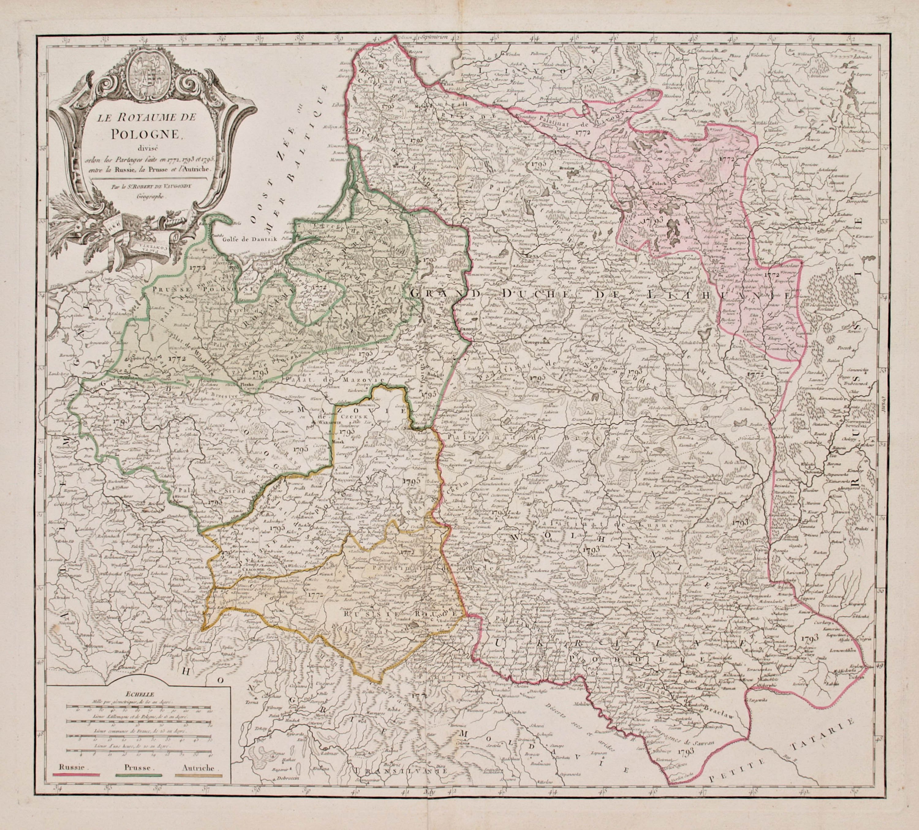
Map of the lands of the Republic, taken from "Nouvelle Atlas Universel...", published by Hyacinthe Langlois, third state, Paris 1802
copperplate engraving colored in period, 50 x 55,8 cm (plate imprint)
good state of preservation, traces of folds, paper loss in lower left corner, two moth holes
Imago Poloniae, 47/4


![Poland car map. Cracow [1945].](https://img1.one.bid/img/6508/1873705_1x.webp?1713823200)
![Poland car map. Cracow [1945].](https://img1.one.bid/img/6508/1873705_2x.webp?1713823200)


![[MAP]. MAP OF POLAND 1 : 500 000. OLSZTYN. [Sheet ] 3. w-wa 1947....](https://img1.one.bid/img/6363/1859794_1x.webp?1713045600)


Recently viewed
Please log in to see lots list
Favourites
Please log in to see lots list