


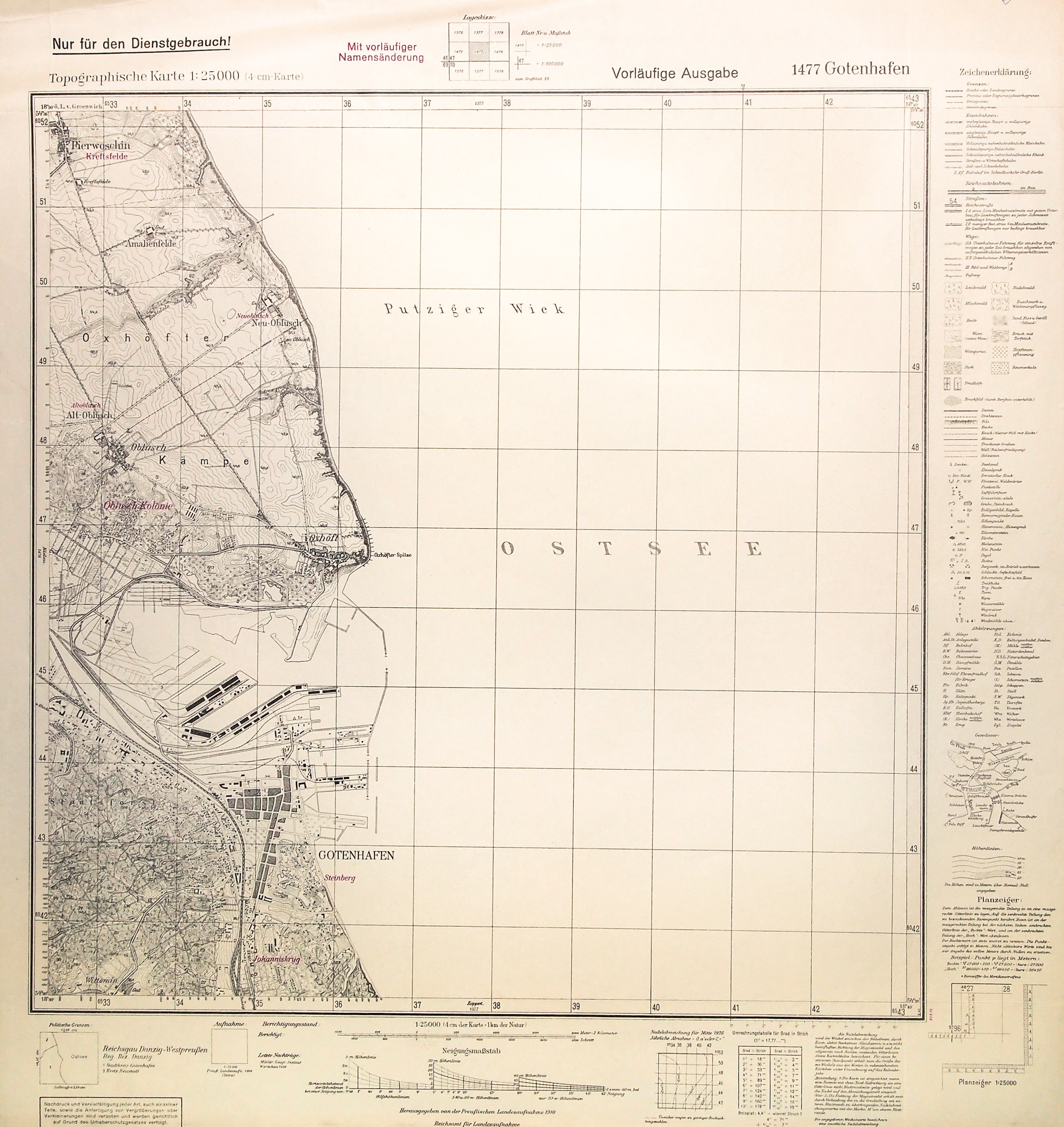
GDYNIA, PORT. Occupation map of 1940. Witomino in the south, Pierwoszyno in the north. The germanized names of the districts of Gdynia and surrounding towns are marked in red. The Germans showed on the plan only the southern part of the port, originally intended for yachts. They kept the rest - where the Kriegsmarine was stationed - secret. Scale 1 : 25,000, published by Reichsamt..., after 1939 (date on map: 1938); fb., legend; bicolor, st. bdb., traces of folding, folds top edge; dimensions 538x578 mm; 1477 Gotenhafen .Rare.


Recently viewed
Please log in to see lots list
Favourites
Please log in to see lots list