Description
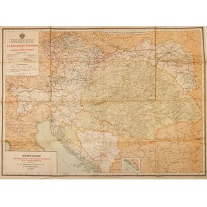
1. map of the Austro-Hungarian railroad network, ca. 1900.
Übersichtskarte k..k. österreichische Staatsbahnen
Published by the Ministry of Railways, print. Karl Prochaska, cieszyn
Color lithograph, paper; 83.5 x 113.5 cm (1:1250000)
Condition: tears, scuffing, minor paper loss
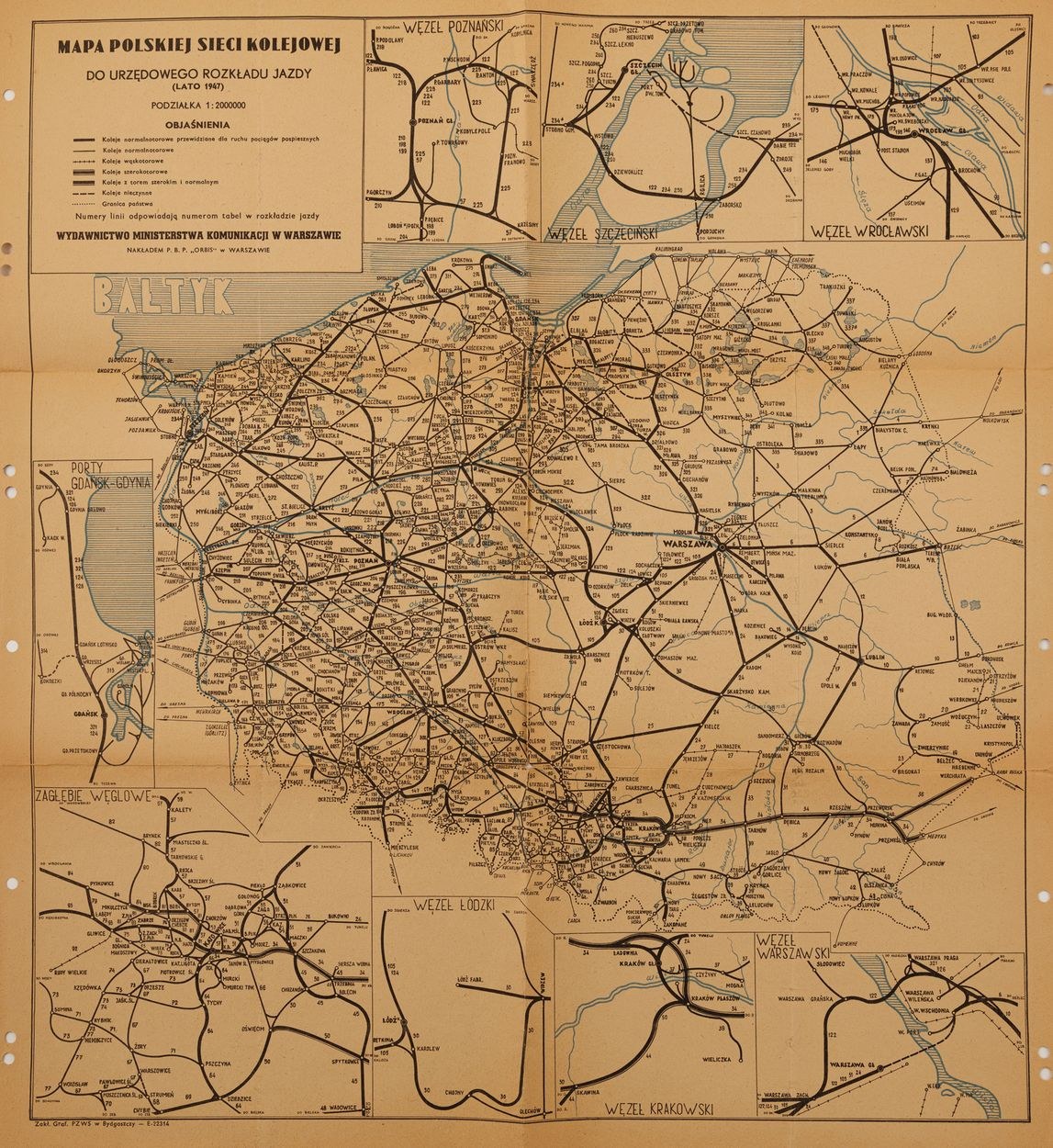
2 Double-sided map: Polish railroad network, Important lines of international communication
Ministry of Communication Publishing House, Warsaw, 1947
Two-color print, paper; 53.5 x 49.5 cm
Condition: perforations on margins, coloring in crayons and names in pencil (by Tadeusz Trzciński), tears on folding edges
Asking price 300
Estimate 500 - 600
Auction 209, 29.01.2022


![[MAP]. MAP OF POLAND 1 : 500 000. OLSZTYN. [Sheet ] 3. w-wa 1947....](https://img1.one.bid/img/6363/1859794_1x.webp?1713045600)


![Automobile MAP of Poland 1 : 2,000,000 with list of gas stations by 'Karpaty' Nakł. Karpaty Sp. z o.o., Lviv [1933].](https://img1.one.bid/img/6145/1794990_1x.webp?1709593200)
![Automobile MAP of Poland 1 : 2,000,000 with list of gas stations by 'Karpaty' Nakł. Karpaty Sp. z o.o., Lviv [1933].](https://img1.one.bid/img/6145/1794990_2x.webp?1709593200)