


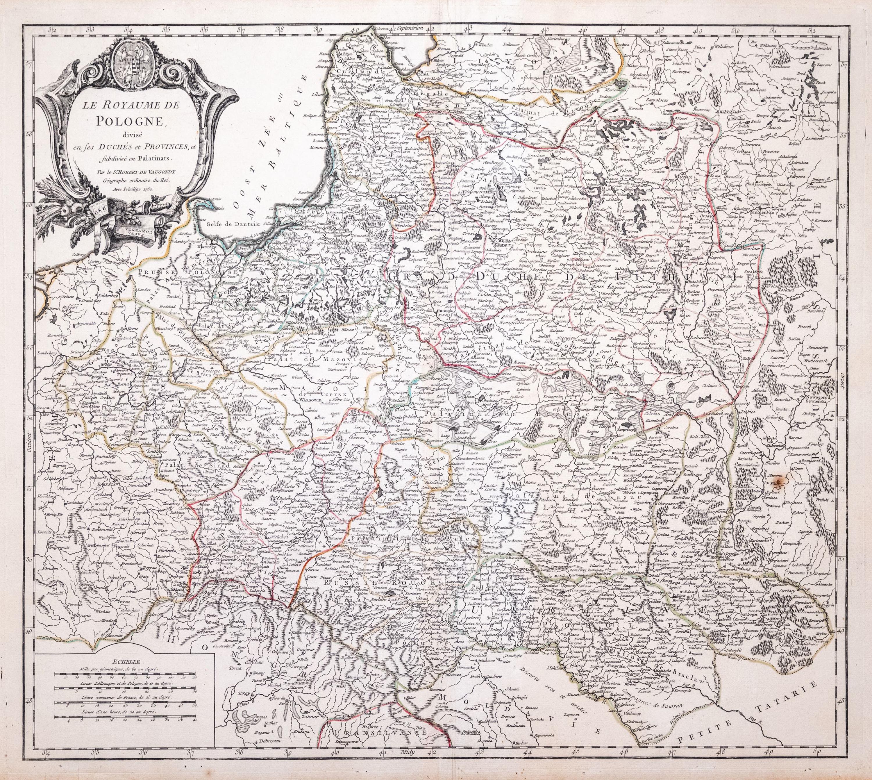
First state, published by Gilles and Didier Robert de Vaugondy, Paris 1752
map taken from the "Atlas Universel"
line-colored copperplate, 49.5 x 56 cm (plate imprint), very good condition
Imago Poloniae K47/2


![Poland car map. Cracow [1945].](https://img1.one.bid/img/6508/1873705_1x.webp?1713823200)
![Poland car map. Cracow [1945].](https://img1.one.bid/img/6508/1873705_2x.webp?1713823200)


![[MAP]. MAP OF POLAND 1 : 500 000. OLSZTYN. [Sheet ] 3. w-wa 1947....](https://img1.one.bid/img/6363/1859794_1x.webp?1713045600)


Recently viewed
Please log in to see lots list
Favourites
Please log in to see lots list