


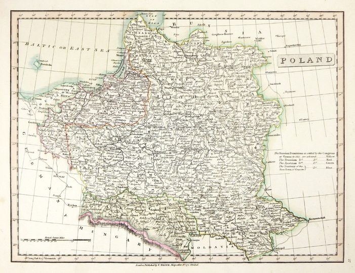
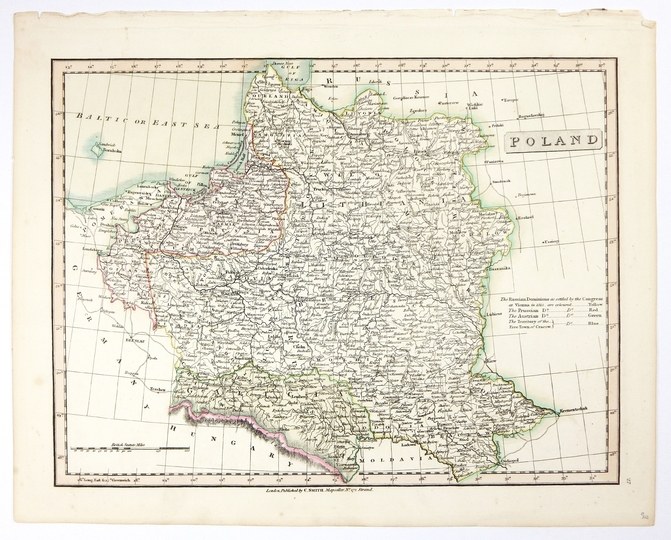
[POLAND]. Poland. Copperplate colored engraving form. 26.3x34.8 on ark. 31.7x39.6 cm.
Imago Pol. K60/16. third state of Charles Smith's map of Poland published in London in 1816. The map was part of "Smith's New General Atlas" (London 1816). Title at right edge, below it an explanation of the four colors marking the borders of the partitions (beginning with the words: "The Russian Dominions as settled by the Cogress at Vienna in 1815"). In the lower left corner a linear scale. Under the lower frame, publishing data (without date). In the lower right corner pag. 27. The first version of the map was published in 1808, here corrections were made due to territorial changes. Small folds in upper margin, good condition.


![[MAP]. MAP OF POLAND 1 : 500 000. OLSZTYN. [Sheet ] 3. w-wa 1947....](https://img1.one.bid/img/6363/1859794_1x.webp?1713045600)


Recently viewed
Please log in to see lots list
Favourites
Please log in to see lots list