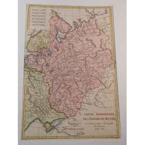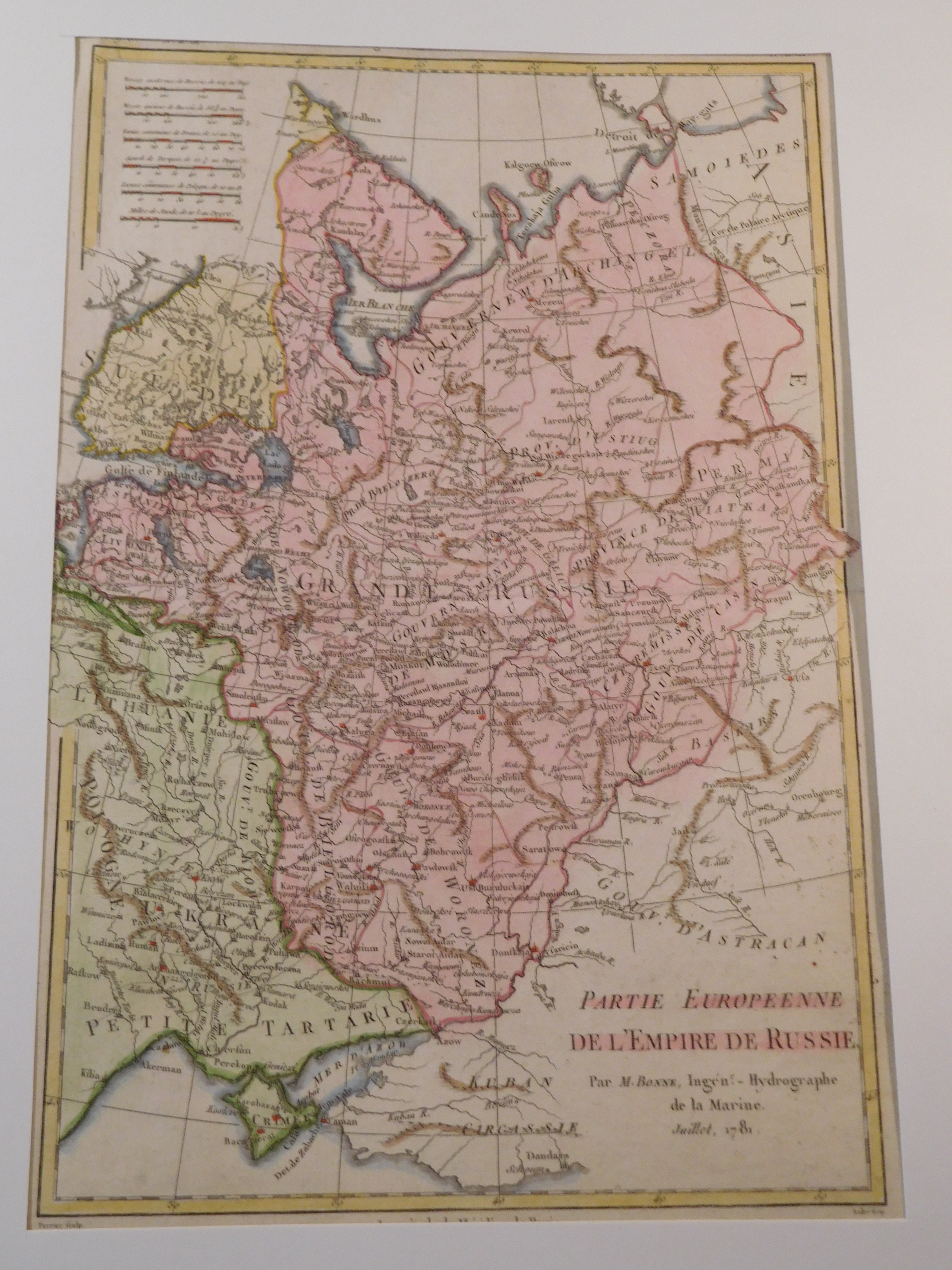
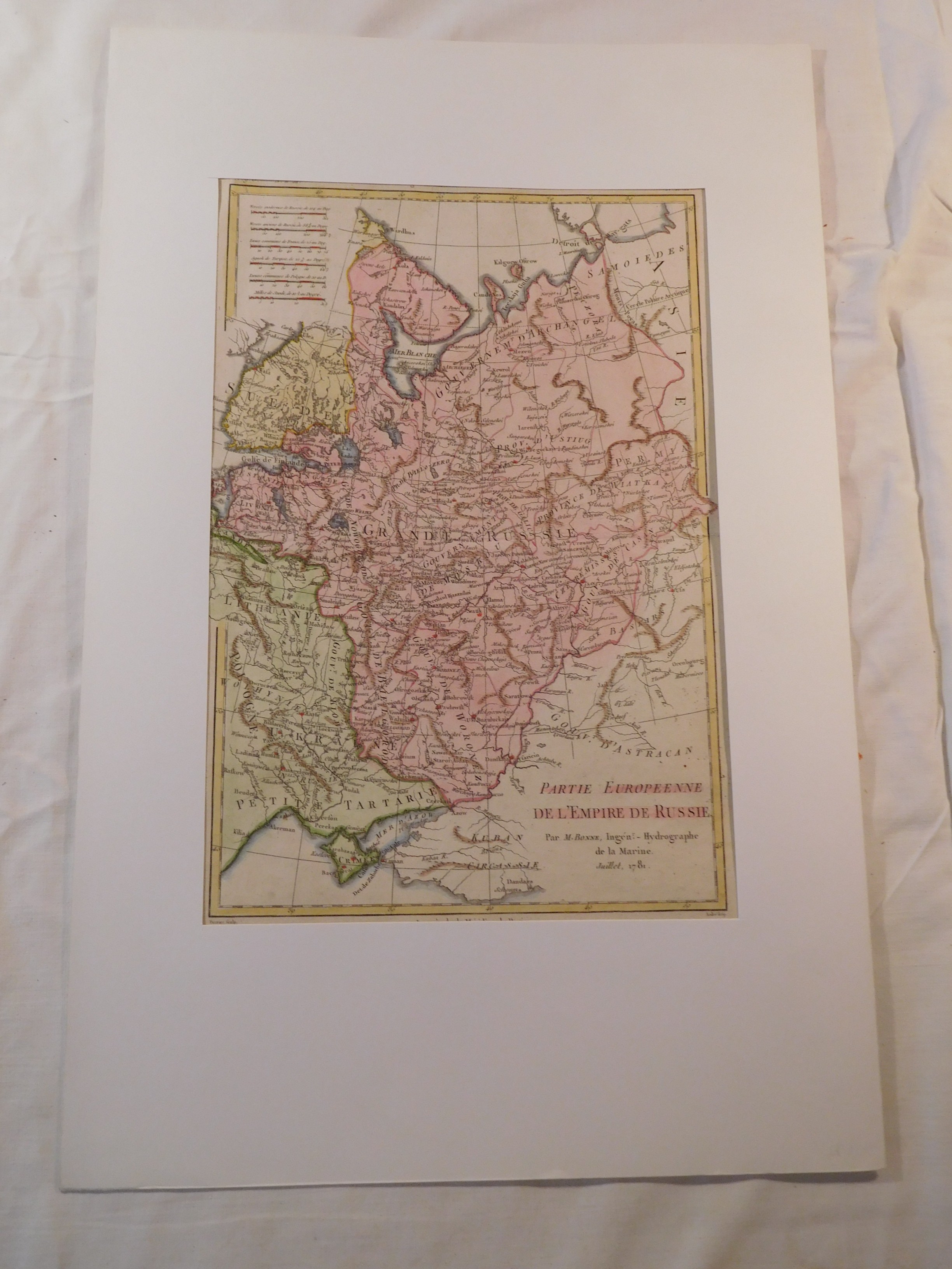
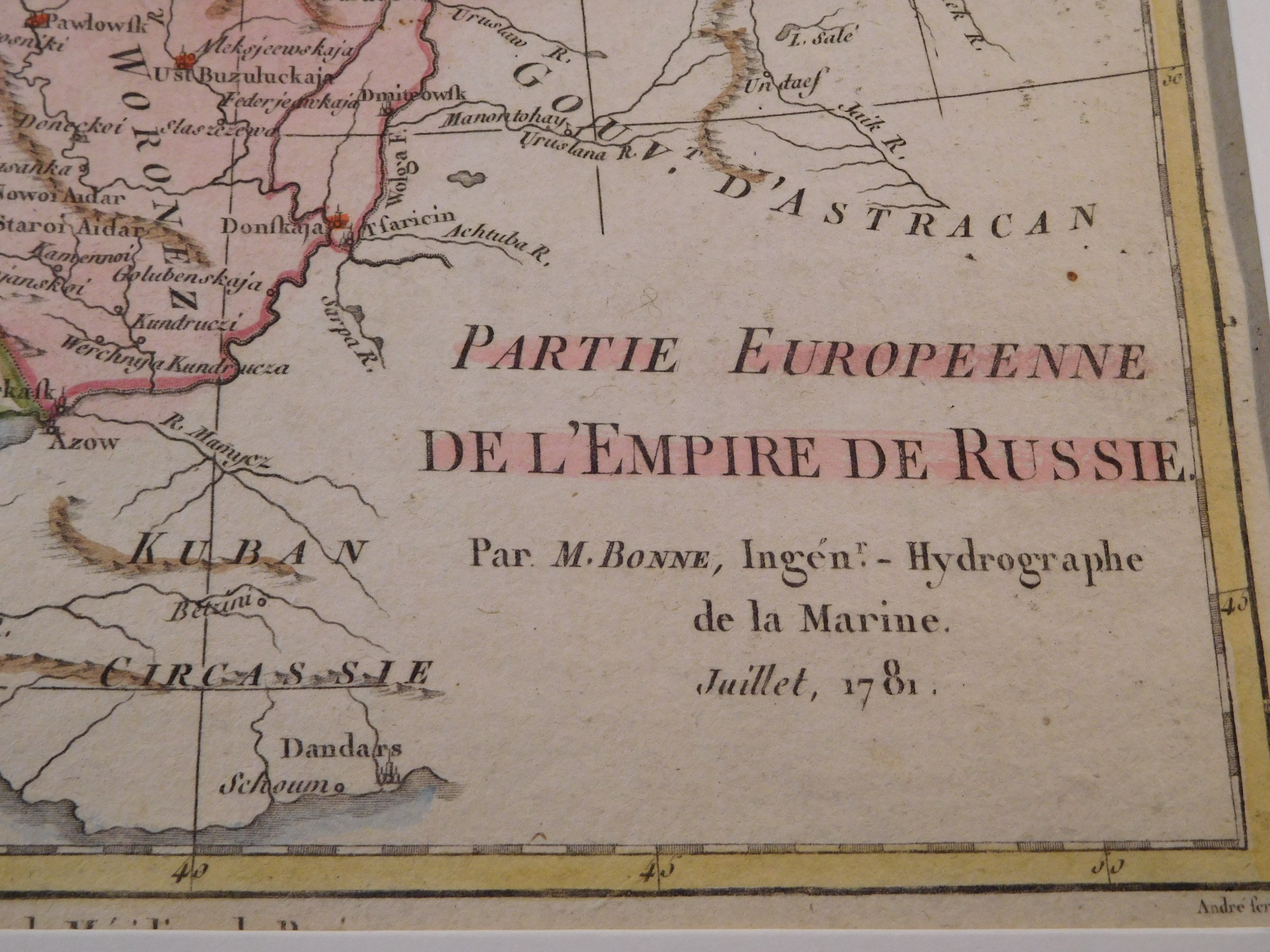
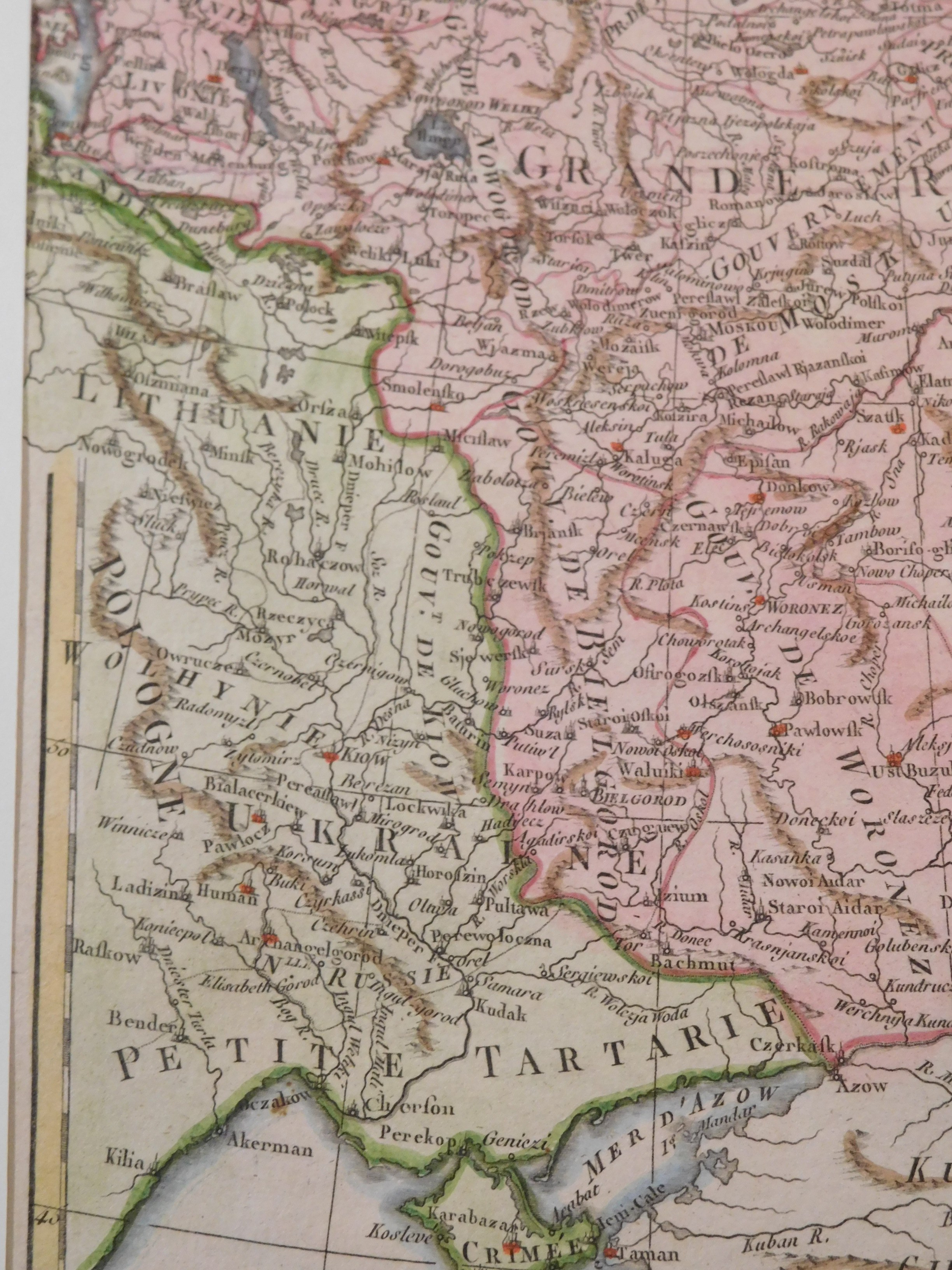
40. BONNE RIGOBERT, PARTIE EUROPEENNE DE L'EMPIRE RUSSE.
Paris 1781, Lattre and Delalain, drawing by André, eng.Perrier, 21 x 32 cm; (sheet: 26 x 37.5 cm), passe-partout 32.5 x 50 cm.
Copperplate colored map of part of European Russia from the atlas of the famous geographer, engineer and hydrologist Rigobert Bonne (1727-1794) "Atlas moderne". The map shows a large part of the former Republic of Poland (Volhynia, Podolia, Grodno, Kurland) and today's Ukraine (Kherson, Dnieper, Kiev, Chernihiv). An interesting feature of the map is that the geographical name "Ukraine" is used for the governorates-areas from Podolia to Izium and Bahmut. The map is framed in white passe-partout.
Piece db preserved, clear imprint of copperplate, distinct green and pink and yellow colors, stains in margins; half trace of folding in atlas; other than these flaws flawless.


![Carte de la Grande Grèce, y compris la Sicile, dressée pour l'intelligence de l'Histoire Ancienne de Mr. Rollin..., par le S[ieur] d'Anville, Géographe ord[inaire] du Roi; Mars 1738](https://img1.one.bid/img/6551/1837762_1x.webp?1712268000)
![Carte de la Grande Grèce, y compris la Sicile, dressée pour l'intelligence de l'Histoire Ancienne de Mr. Rollin..., par le S[ieur] d'Anville, Géographe ord[inaire] du Roi; Mars 1738](https://img1.one.bid/img/6551/1837762_2x.webp?1712268000)