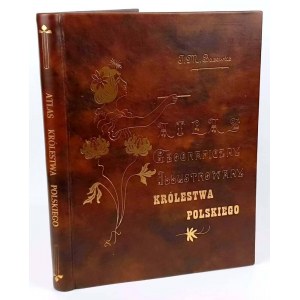


BAZEWICZ Józef Michał
GEOGRAPHICAL ILLUSTRATED ATLAS OF THE KINGDOM OF POLAND based on the latest sources compiled.
Edited by J.M. Bazewicz
Co-edited with "Description of the Kingdom of Poland for the Geographical Atlas Illustrated compiled under the editorship of J.M. Bazewicz."
J.M. Bazewicz Publishing House, Warsaw. Aleje Jerozolimskie No. 25. druk. i Lit. B.A. Bukaty, Warsaw.Warsaw, 1907. druk. by A. Pęczalski and K. Marszałkowski, Erywańska No. 2/4. cards [2], 85, 118, [2] format 23.5x30.5 cm.
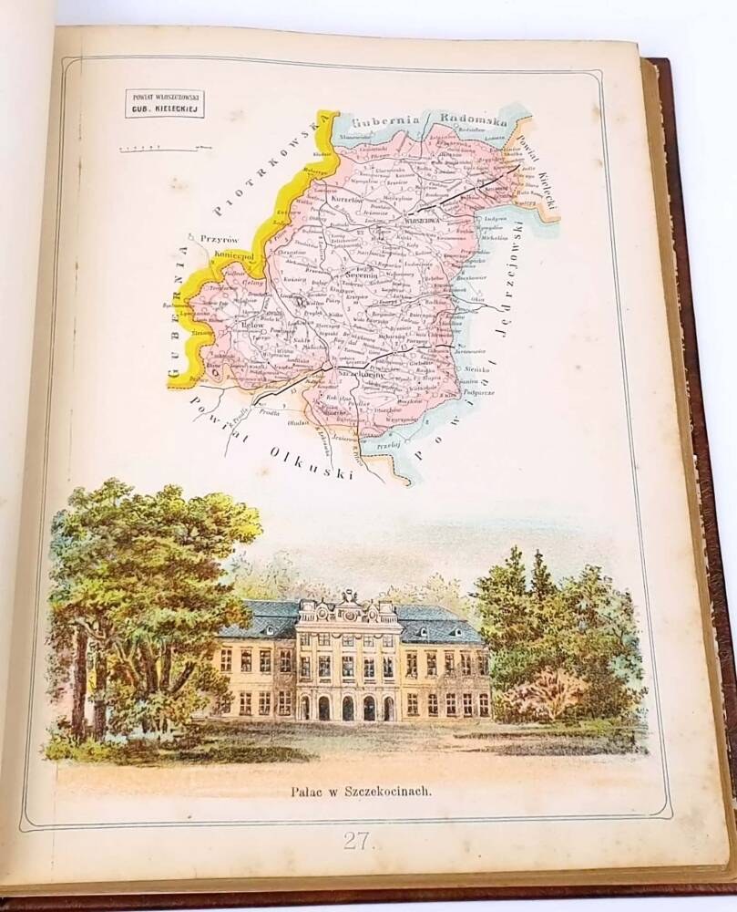
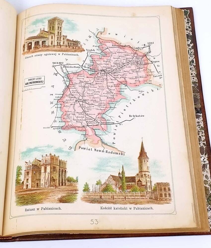
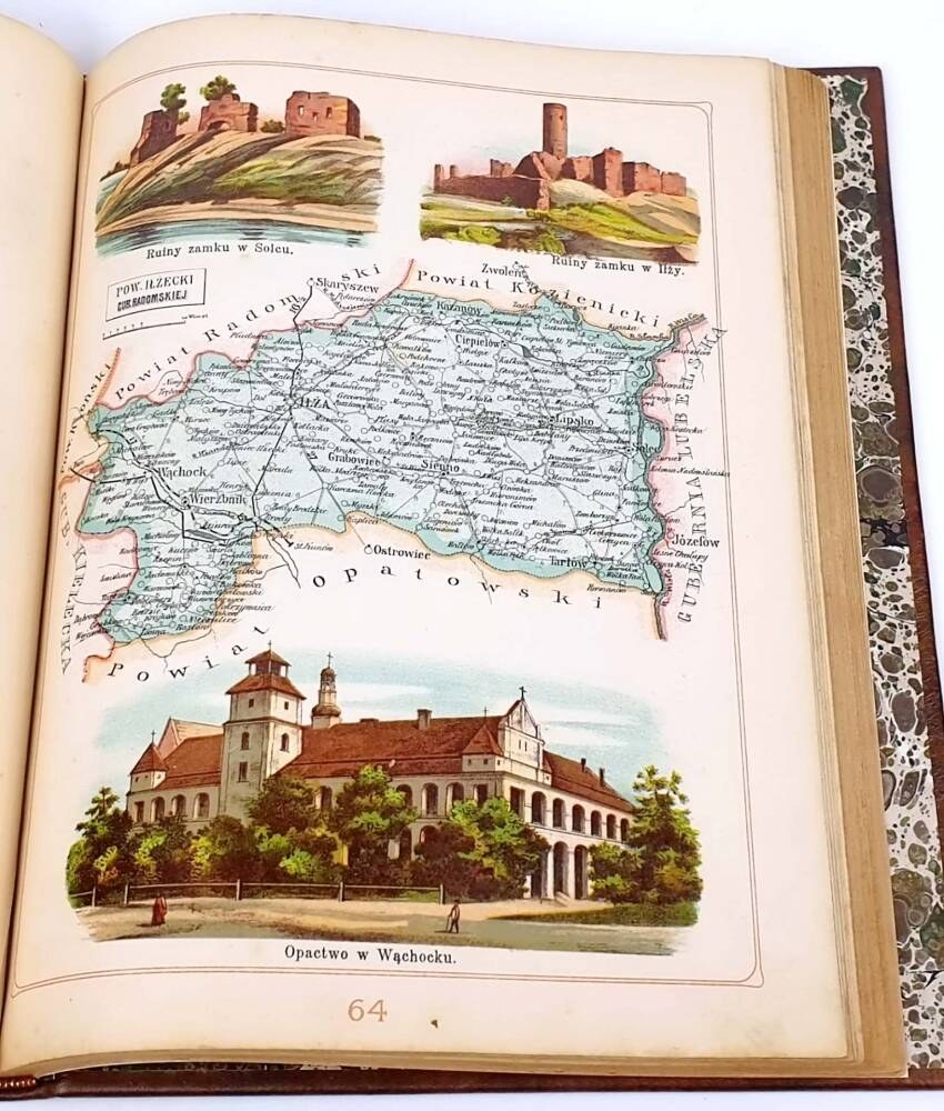
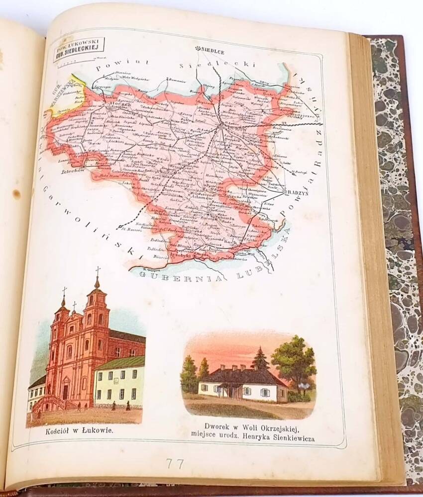
Contents: lithographed title page, index, 1 double-page map of the Kingdom of Poland, 85 single-sheet maps with individual districts, 118 pages with description of districts, 2str. index of localities
HARDCOVER FULL LEATHER CONTEMPORARY BINDING MODELED AFTER PUBLISHER'S BINDING OF THE PERIOD. STRIKING ART NOUVEAU STYLED GILT LETTERING ON THE FRONT AND SPINE. HAND MARBLED BOARDS. CARD EDGES GILT
Condition DB/ soiled corners, discoloration in places, pages with text yellowed, EFFECTIVE BINDING


![[Castle on Pieskowa Skala] Cover of notebook no. I - ATLAS GEOGRAFICZNY ILLUSTROWANY KRÓLESTWA POLSKIEGO. Warsaw [1902].](https://img1.one.bid/img/6508/1874737_1x.webp?1713909600)
![[Castle on Pieskowa Skala] Cover of notebook no. I - ATLAS GEOGRAFICZNY ILLUSTROWANY KRÓLESTWA POLSKIEGO. Warsaw [1902].](https://img1.one.bid/img/6508/1874737_2x.webp?1713909600)


![J. M. BAZEWICZ - Model atlas of the Republic of Poland [Garwolin county, Lubelskie province]; List of publications by J. M. Bazewicz; Invitation to prepayment. Warsaw [1921].](https://img1.one.bid/img/6508/1869889_1x.webp?1713564000)
![J. M. BAZEWICZ - Model atlas of the Republic of Poland [Garwolin county, Lubelskie province]; List of publications by J. M. Bazewicz; Invitation to prepayment. Warsaw [1921].](https://img1.one.bid/img/6508/1869889_2x.webp?1713564000)
![KAMIEŃSKI Antoni - Spirit-Revolutionary. Sketches from years past 1905-1907 [Warsaw 1907]. Published....](https://img1.one.bid/img/6580/1879035_1x.webp?1714082400)
![KAMIEŃSKI Antoni - Spirit-Revolutionary. Sketches from years past 1905-1907 [Warsaw 1907]. Published....](https://img1.one.bid/img/6580/1879035_2x.webp?1714082400)