


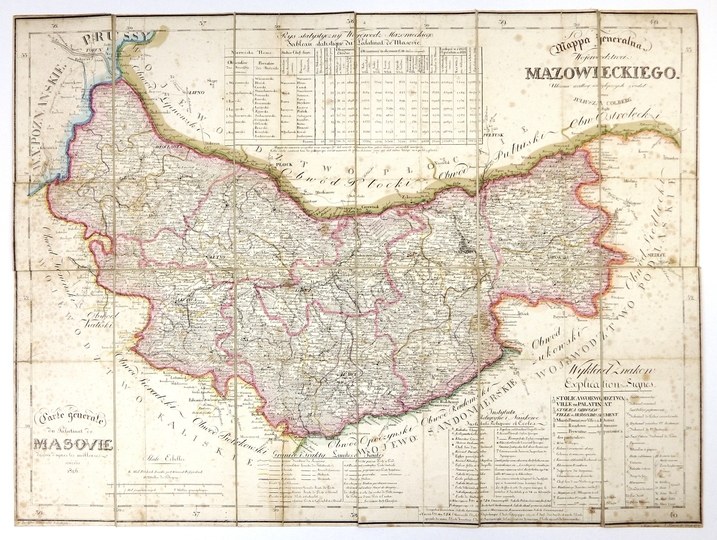
[MAZOWSZE]. Mappa jeneralna Woiewodztwa Mazowieckiego. Arranged according to the best sources by Julius Colberg. Carte génerale du Palatinat de Masovie dressée d'apres les meilleures sources. Colored lithograph form. 43x57.7 cm.
Map elaborated. by Juliusz Kolberg taken from his "Atlas of the Kingdom of Poland" (CKZK 5, 82), printed in Warsaw in 1827 at the School Lithographic Institute, lithographed by J. Slawinski. Titles in the upper right and lower left corners, in the lower right corner a legend, under the upper and above the lower frame tables with territorial division and statistical data. Above the lower left frame two linear scales. Linear color. Map cut into 12 parts glued together on linen. Clear browning of paper in places .


Recently viewed
Please log in to see lots list
Favourites
Please log in to see lots list