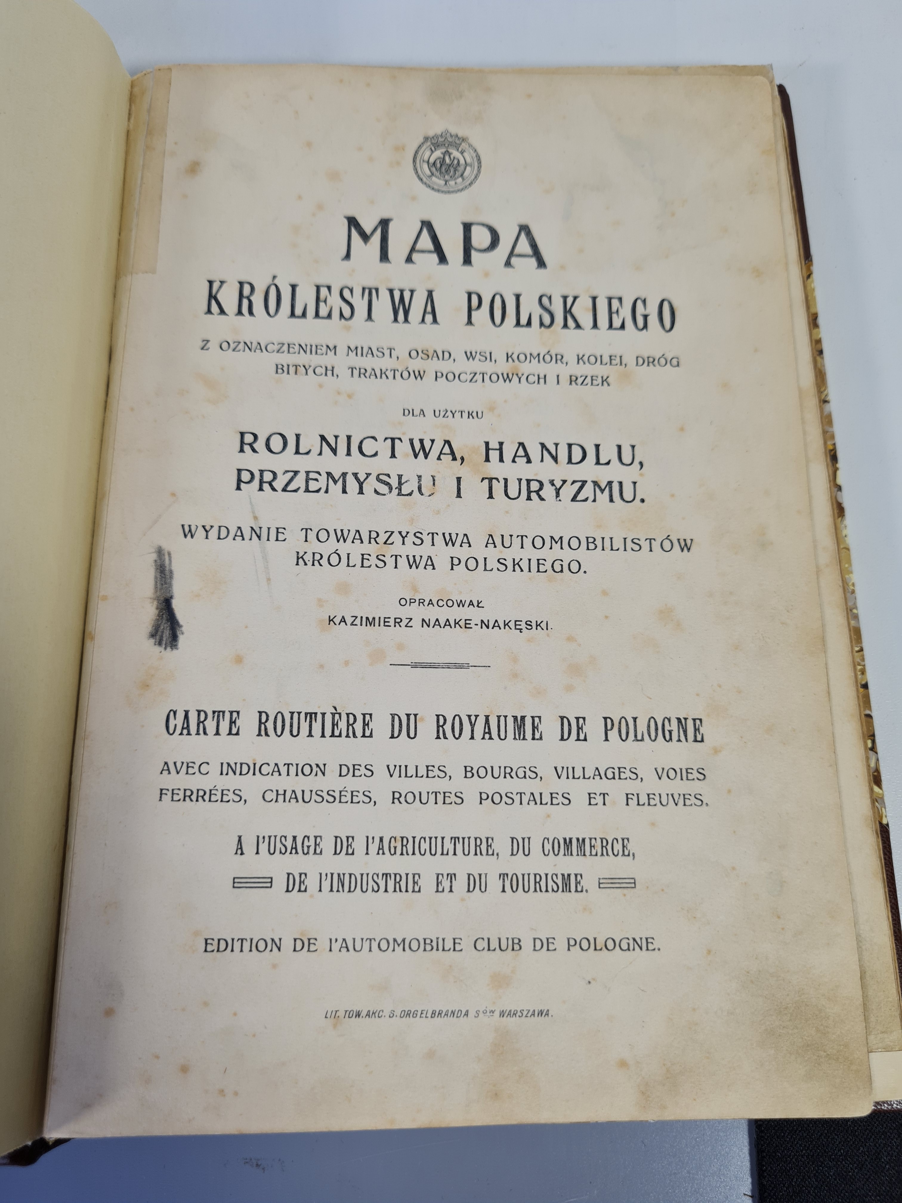
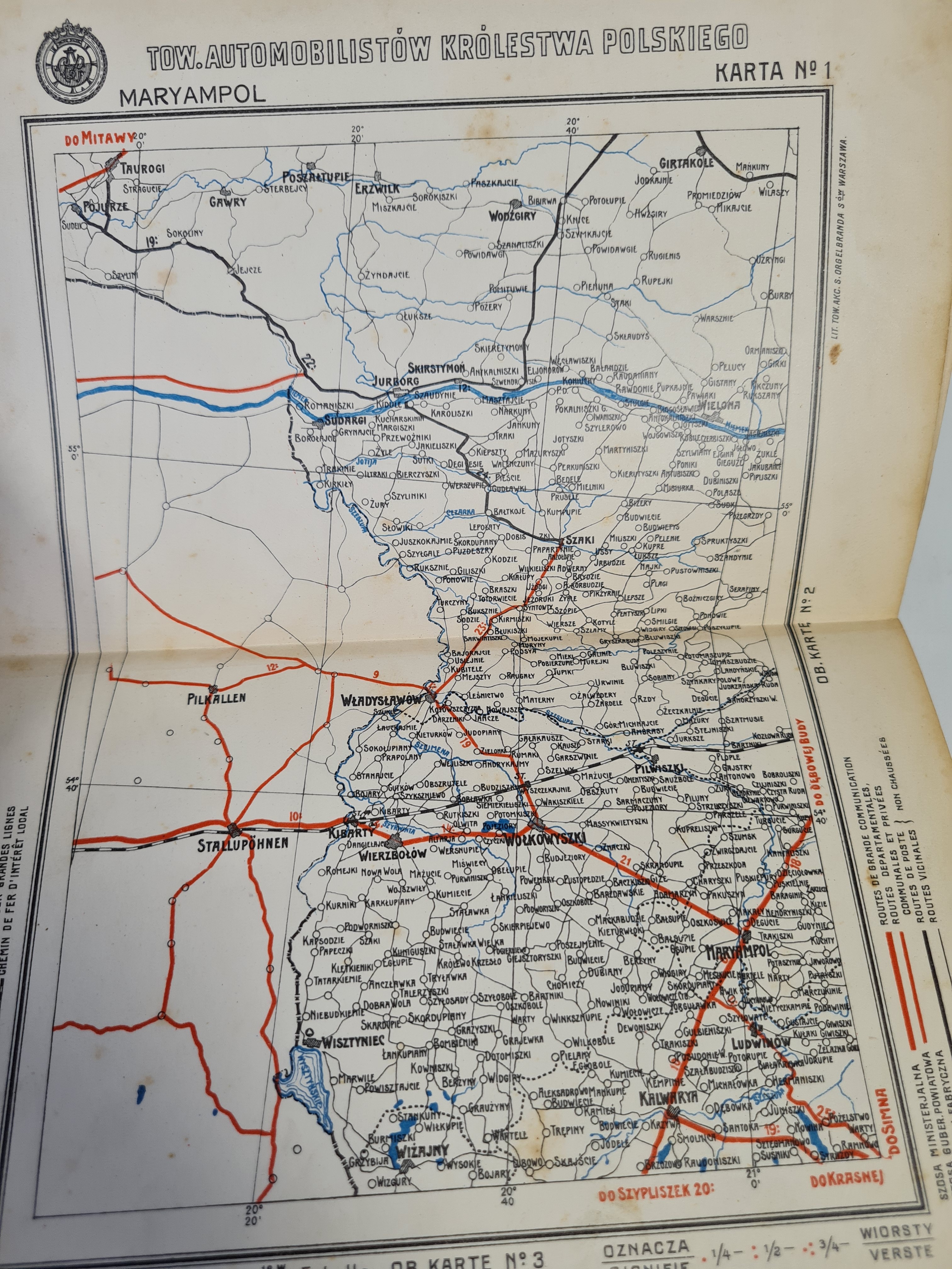
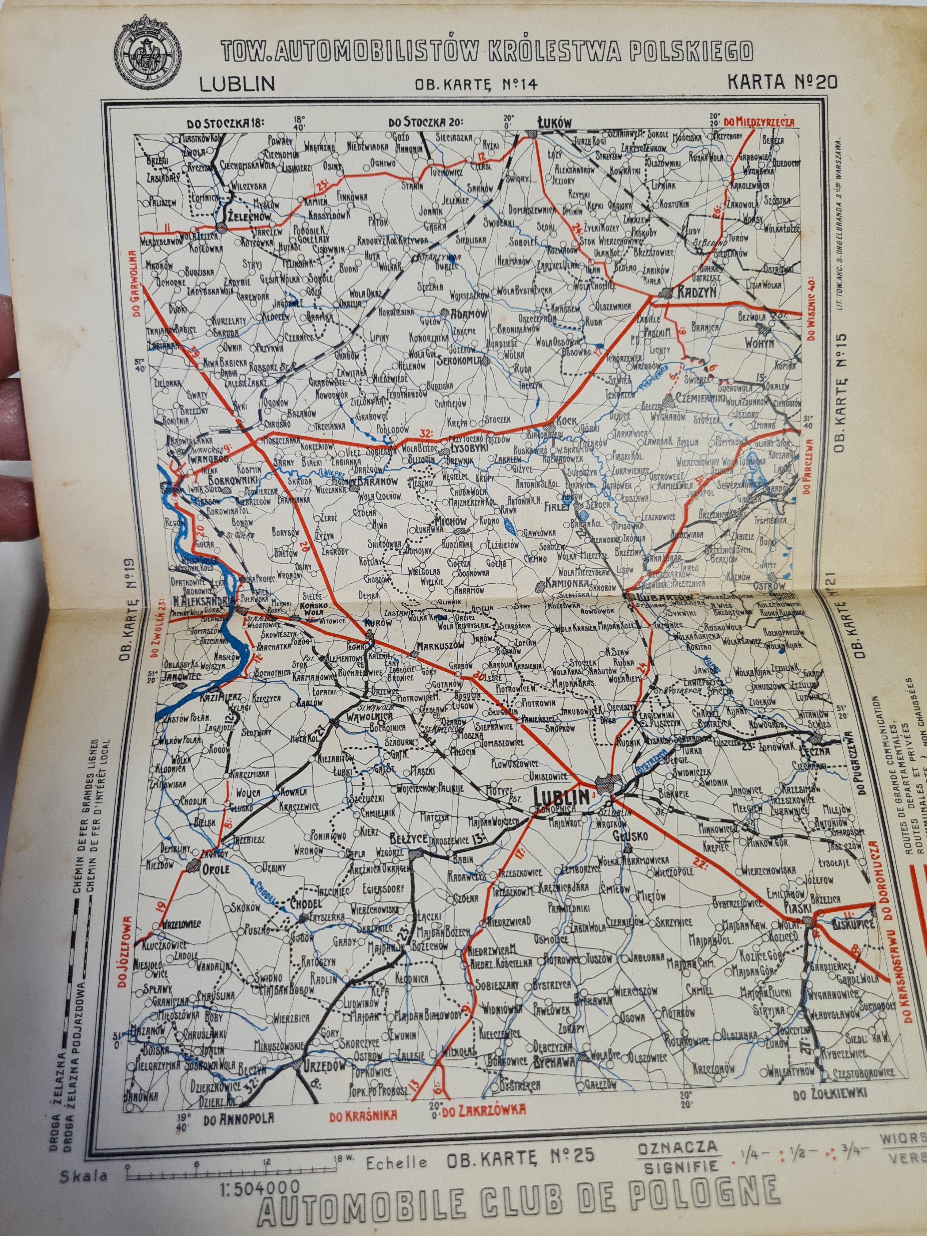
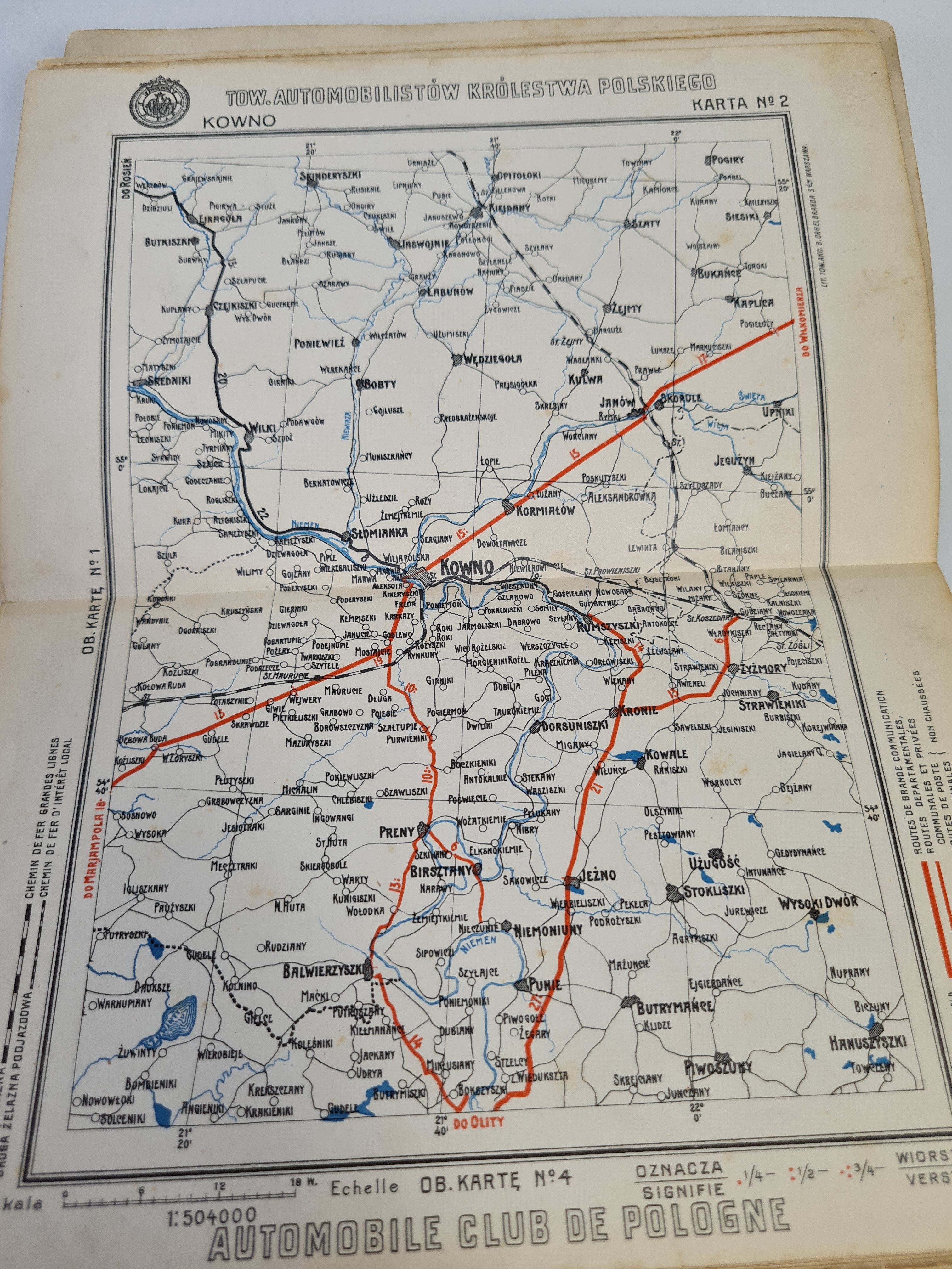
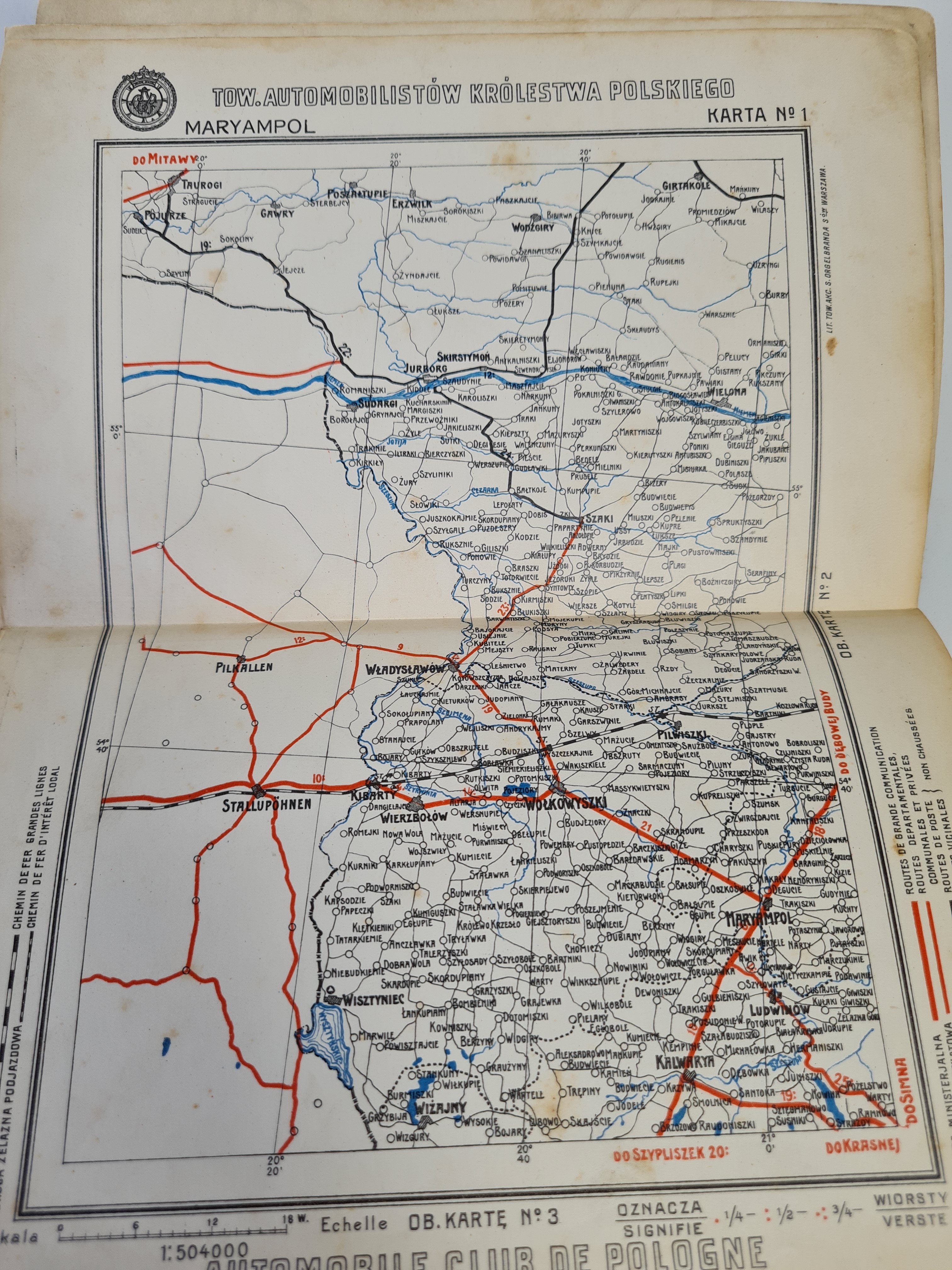
MAP OF THE KINGDOM OF POLAND with indication of towns, settlements, villages, chambers, railroads, beaten roads, postal tracts and rivers for the use of agriculture, commerce, industry and tourism. Compiled by Kazimierz Naake-Nakęski. Fold-out color maps (26), additionally a group card, advertisements outside the text (2).Issued by the Automobile Society of the Kingdom of Poland, Warsaw [1912].Contemporary half leather binding. Dimensions 21x14.5cm. Soiling inside, foxing-discoloration of paper, pen marks in places(but not on maps).
From the preface: (...)The map is the result of a year and a half's work of compiling data, collected from the authorities of the Ministry of Communications, the managements of factories and private individuals who built roads at their own expense(...).


![WITTYG- PIECZĘCIE MIAST DAWNEJ POLSKI Z.1-3 [set in 1 vol.]](https://img1.one.bid/img/6657/1883095_1x.webp?1714428000)