


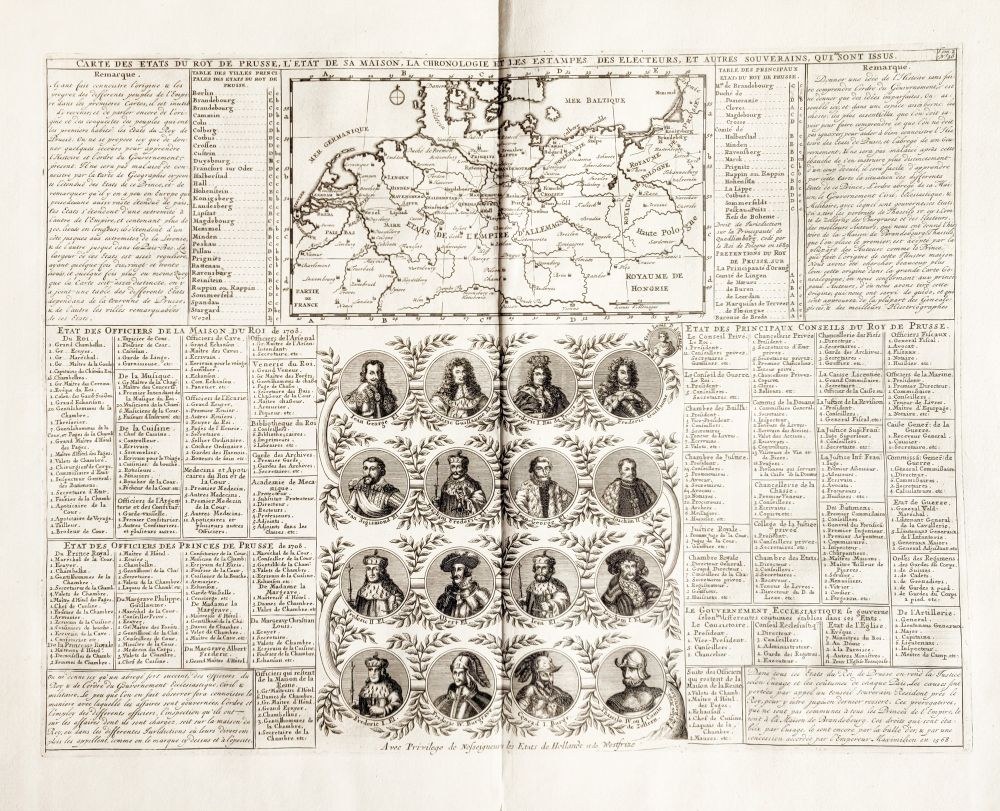
BRANDENBURG, PRUSSIA. CARTE DES ETATS DU ROY DE PRUSSE, L'ETAT DE SA MAISON, LA CHRONOLOGIE ET LES ESTAMPES DES ELECTEURS, ET AUTRES SOUVERAINS, QUI SONT ISSUS taken from: Atlas historique, ou Nouvelle Introduction à l`histoire, a la chronologie et a la Geographie Ancienne et Moderne..., ed. Chatelain Brothers' Bookstore, Amsterdam 1708; the central part of the engraving is occupied by a family tree with 16 portraits of representatives of the Hohenzollern dynasty from the time of the burgraves of Nuremberg, the Prussian princes and finally the kings in Prussia; the tables on the left and right detail the state system: the persons of the court including the kitchen and musicians, the royal council broken down into individual cameras, the organization of the army and the church; in the upper part a map showing the possessions of Prussia with a breakdown of the most important cities and provinces; miedz. p.-b.; st. bdb., minor tear at bottom of fold; board dimensions: 457x346 mm.


![Janotyckh von Adlerstein, Joh[ann]: Archiv des ungarischen Ministeriums und Landesvertheidigungsauschusses...](https://img1.one.bid/img/6570/1845481_1x.webp?1712700000)
![Janotyckh von Adlerstein, Joh[ann]: Archiv des ungarischen Ministeriums und Landesvertheidigungsauschusses...](https://img1.one.bid/img/6570/1845481_2x.webp?1712700000)


Recently viewed
Please log in to see lots list
Favourites
Please log in to see lots list