


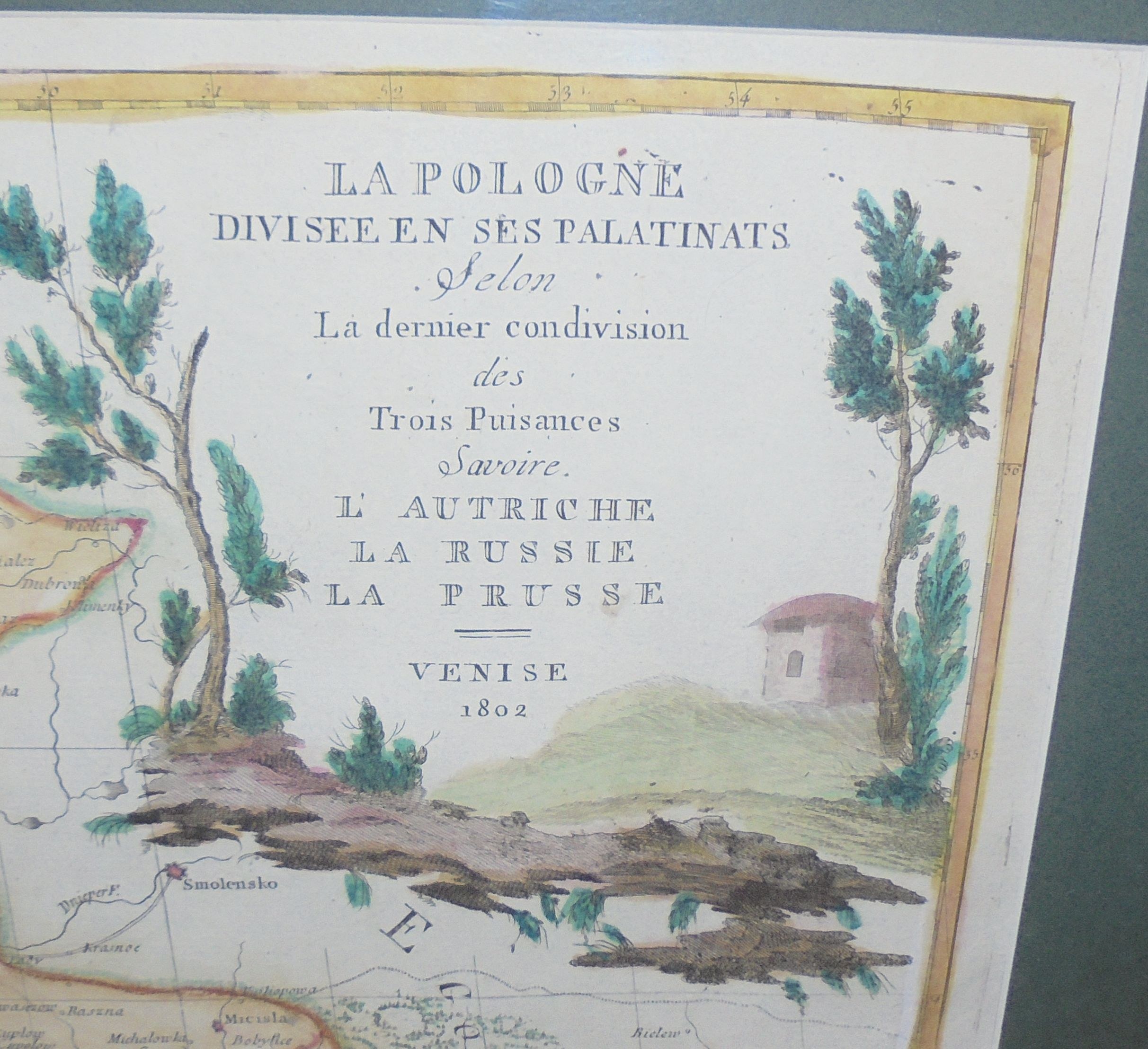
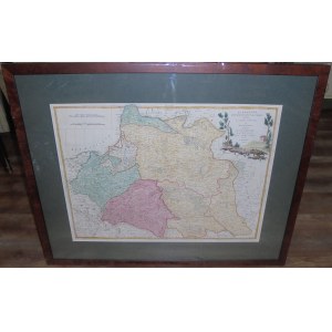
"La Pologne | Divisee en ses Palatinats | Selon | La dernier condivision | des | Trois Puisances | Savoire. | L'Autriche | La Russie | La Prusse | Venise | 1802"
Original copperplate, early 19th century, contemporary colored, 49 x 65.7 cm, framed 73.2 x 91 cm.
The first state of this map was issued by the Venetian publishing house of Antoni Zatta and Sons in 1792, the second edition, which added information about the second partition of Poland , appeared a year later. Subsequent publishing variants (a total of 7 are known) are dated 1802 and differ in details (e.g. the title sometimes says "Savoir" or "Sovoire" instead of "Savoire" as on the piece offered here), on the last one a new publisher - Joseph[Giuseppe] Remondini - was added in the cartouche. The early editions of 1792, 1793 and 1802 (on the edition with "Sovoire") at the southern edges of the RP extend beyond the map's border, here those edges were "trimmed" and matched to the closed (at the bottom, as one tab was left at the top) cartographic grid, just as on the map with Remondini's added signature.
The map was not very up-to-date for the time of its creation, being based on old materials.
An attraction for Toruns - the map does not show Bydgoszcz (for Bydgoszczians the best would be Mercator's map (from the 17th century)- where their city appears up to 3 times).
Okuniew is there twice (once in place of Otwock?) under the names Okuwew and Okoniew.
There may be more similar curiosities.
The CKZK description of z. 6 suggests that the boundaries of the Third Partition were not marked. On the piece offered here, some of the borders are marked differently (sometimes as if they were not completed, e.g. the Russian Second Partition, seemingly begins in the north, but the tip was not drawn), suggesting partitions, possibly division into provinces, hence the coloring not very consistent with the actual results of the partition, there is no legend explaining the different markings on the map.
Good condition: minor soiling and creases.
Bibliography:
a) "Central Catalog of Cartographic Collections in Poland" notebook 6, PAN IGiPZ, Warsaw, 2000, item 151, only one piece in the Cracow collection was noted, no other publishing variants were noted.
b) Niewodniczański T., Kozica K., "Imago Poloniae", Warsaw, 2002, T.2., item K28/7 - describes the third state, with a new cartouche(me here), but with a slight difference in the title, 7 publishing variants (states) are known, the last one has "Savoir" and an additional note by J. Remondini.
Rare.


![Poland car map. Cracow [1945].](https://img1.one.bid/img/6508/1873705_1x.webp?1713823200)
![Poland car map. Cracow [1945].](https://img1.one.bid/img/6508/1873705_2x.webp?1713823200)
![[MAP]. MAP OF POLAND 1 : 500 000. OLSZTYN. [Sheet ] 3. w-wa 1947....](https://img1.one.bid/img/6363/1859794_1x.webp?1713045600)


Recently viewed
Please log in to see lots list
Favourites
Please log in to see lots list