


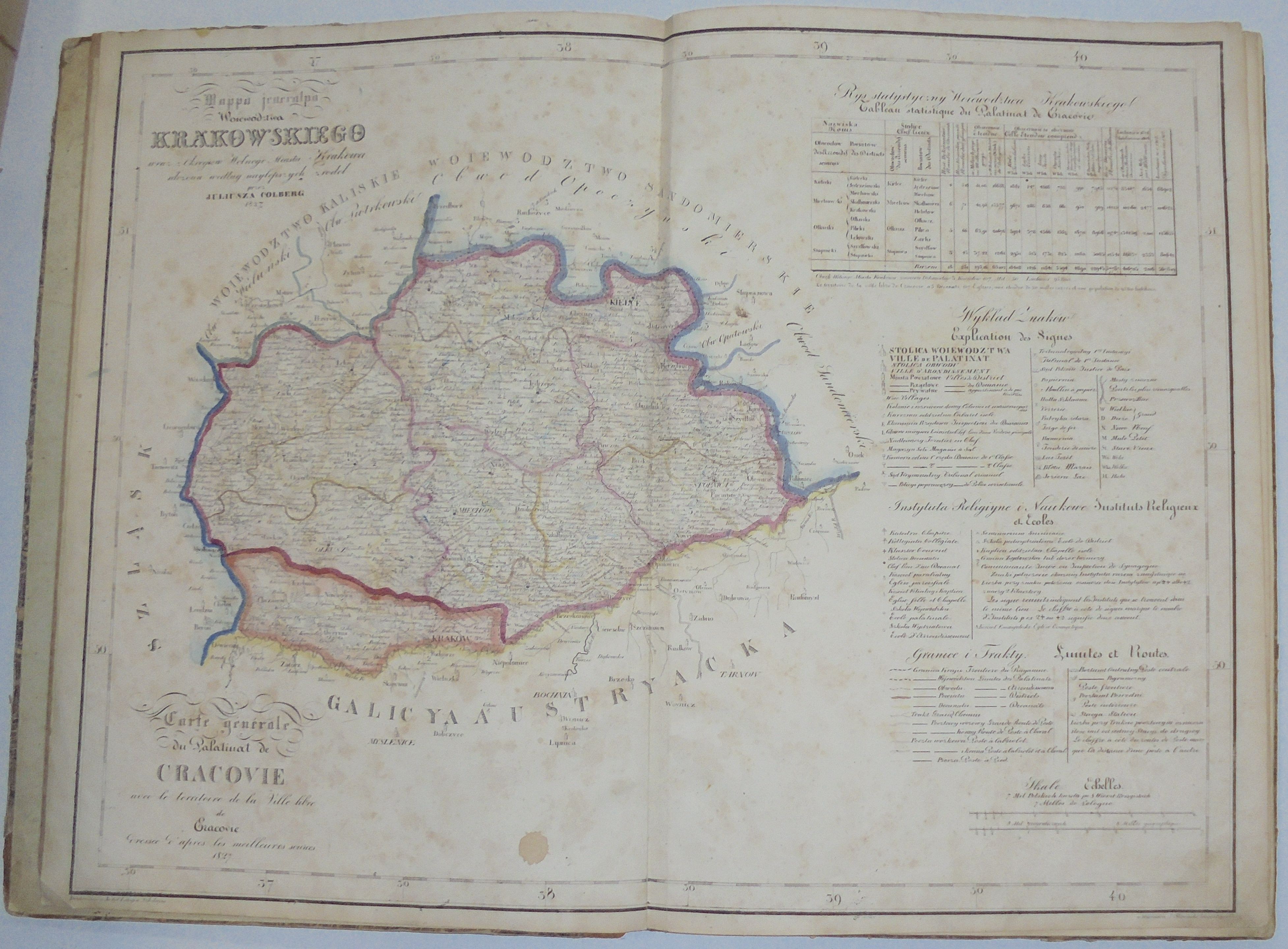
"Atlas of the Polish Kingdom" by Juliusz Kolberg (Colberg), printed by the Warsaw School Lithographic Institute in 1826-27(maps were lithographed by J. Slawinski).
The first such accurate collection of maps of all provinces of the Kingdom of Poland, in Polish. A rarity in the set.
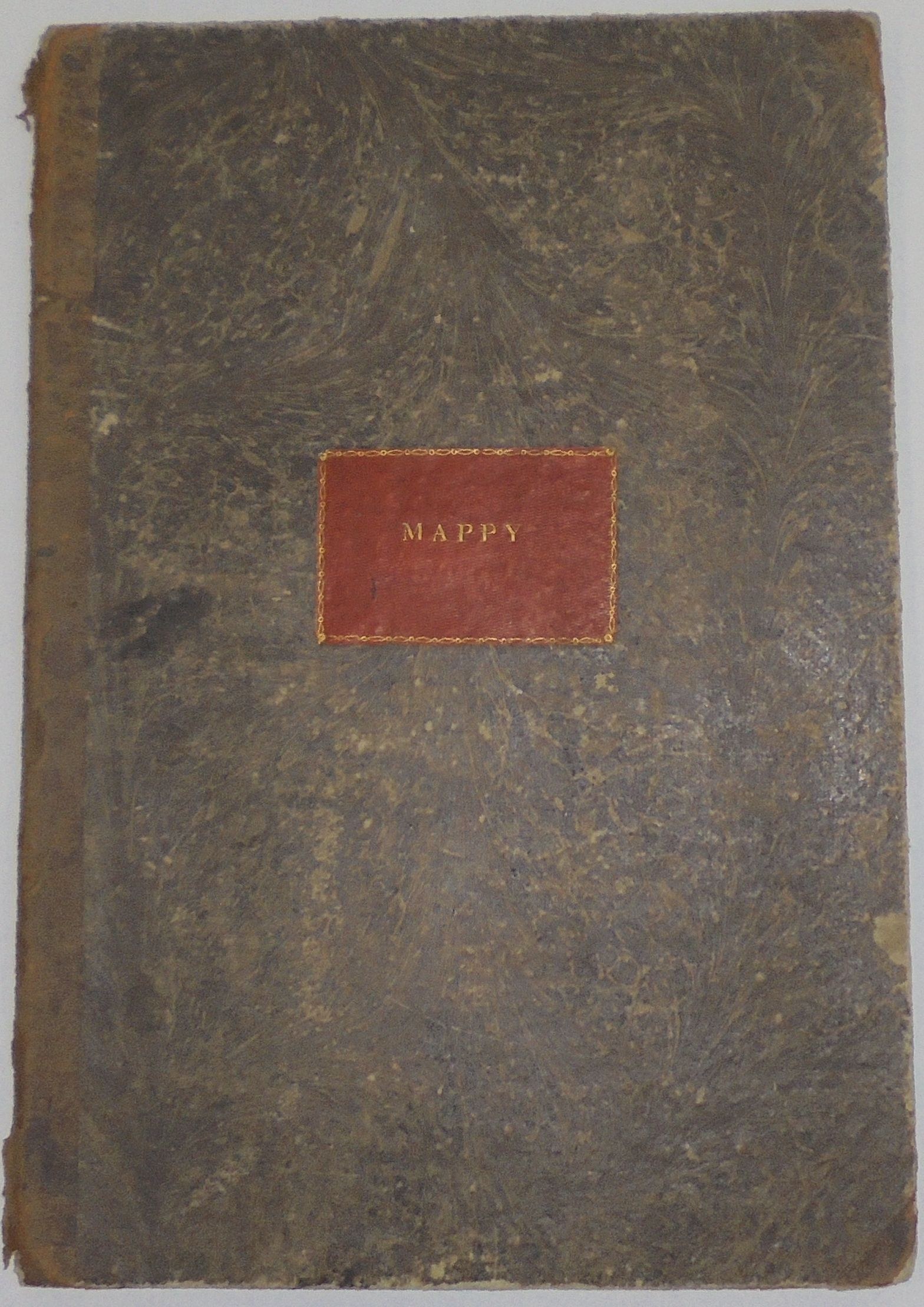
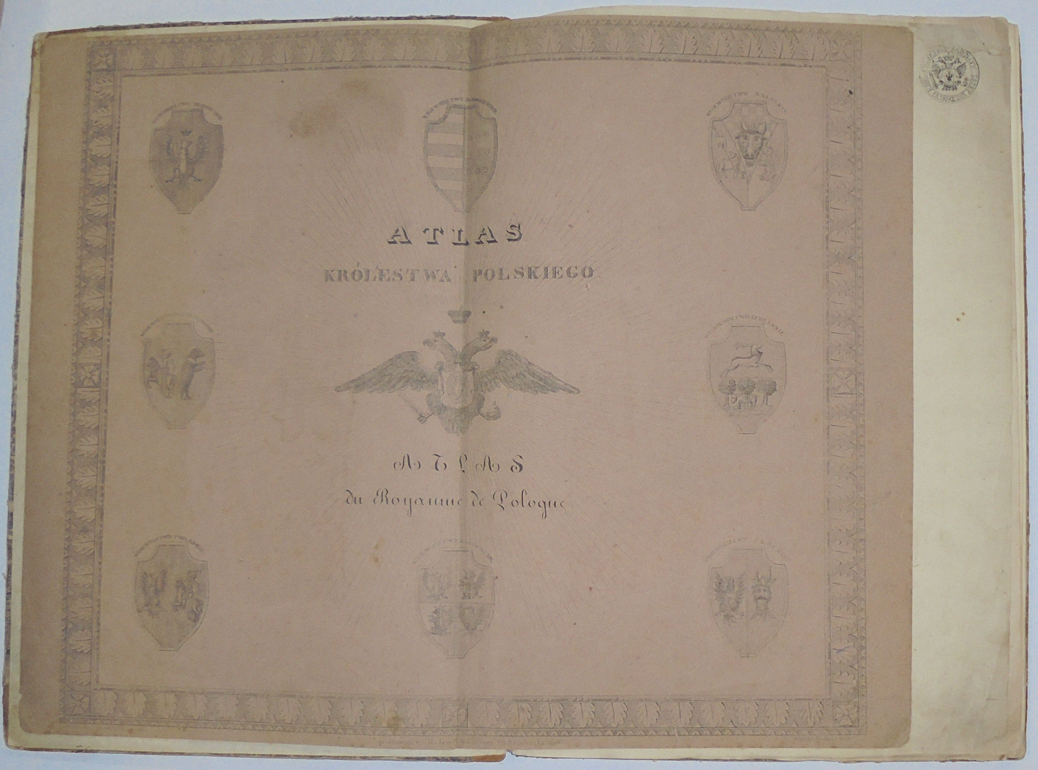
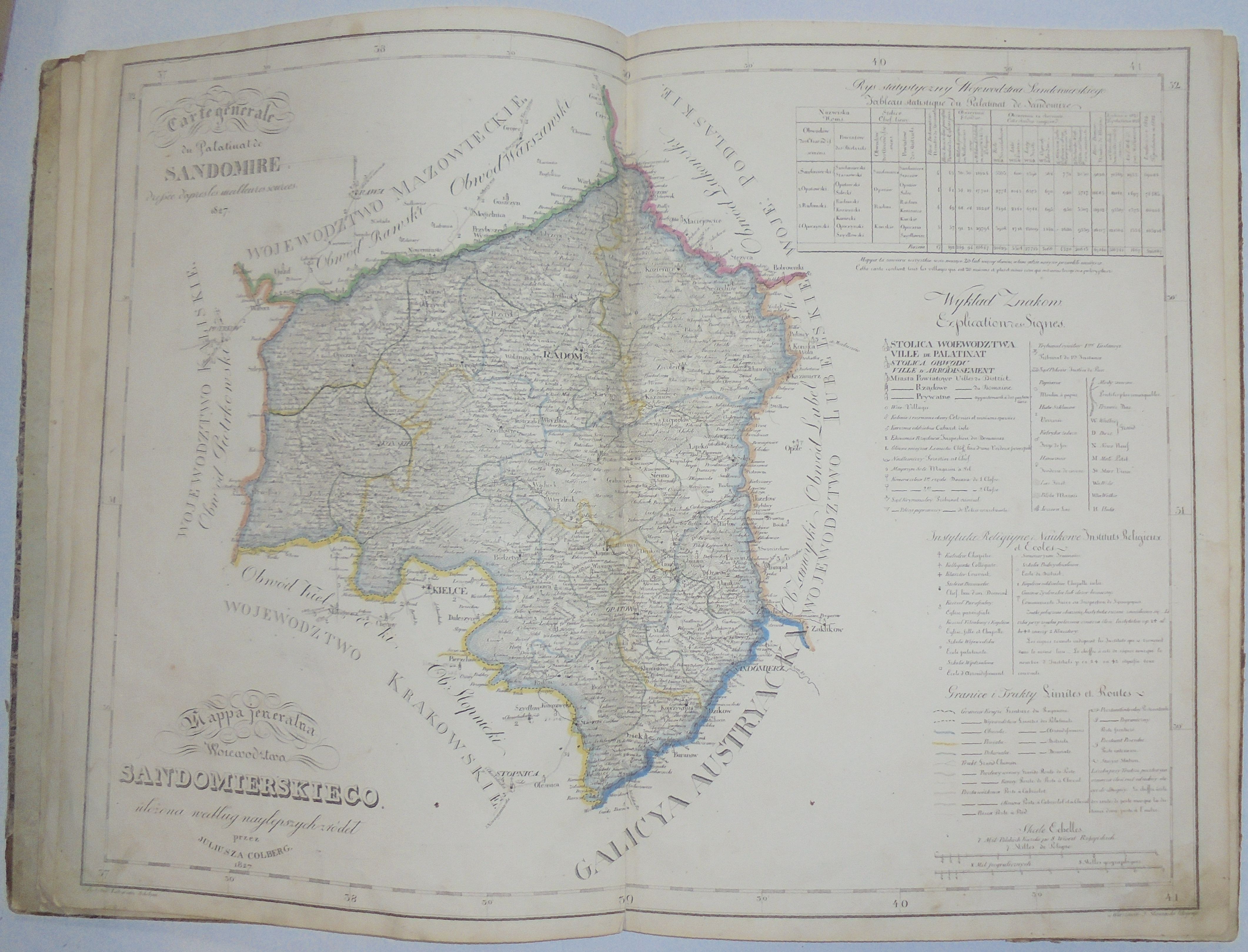
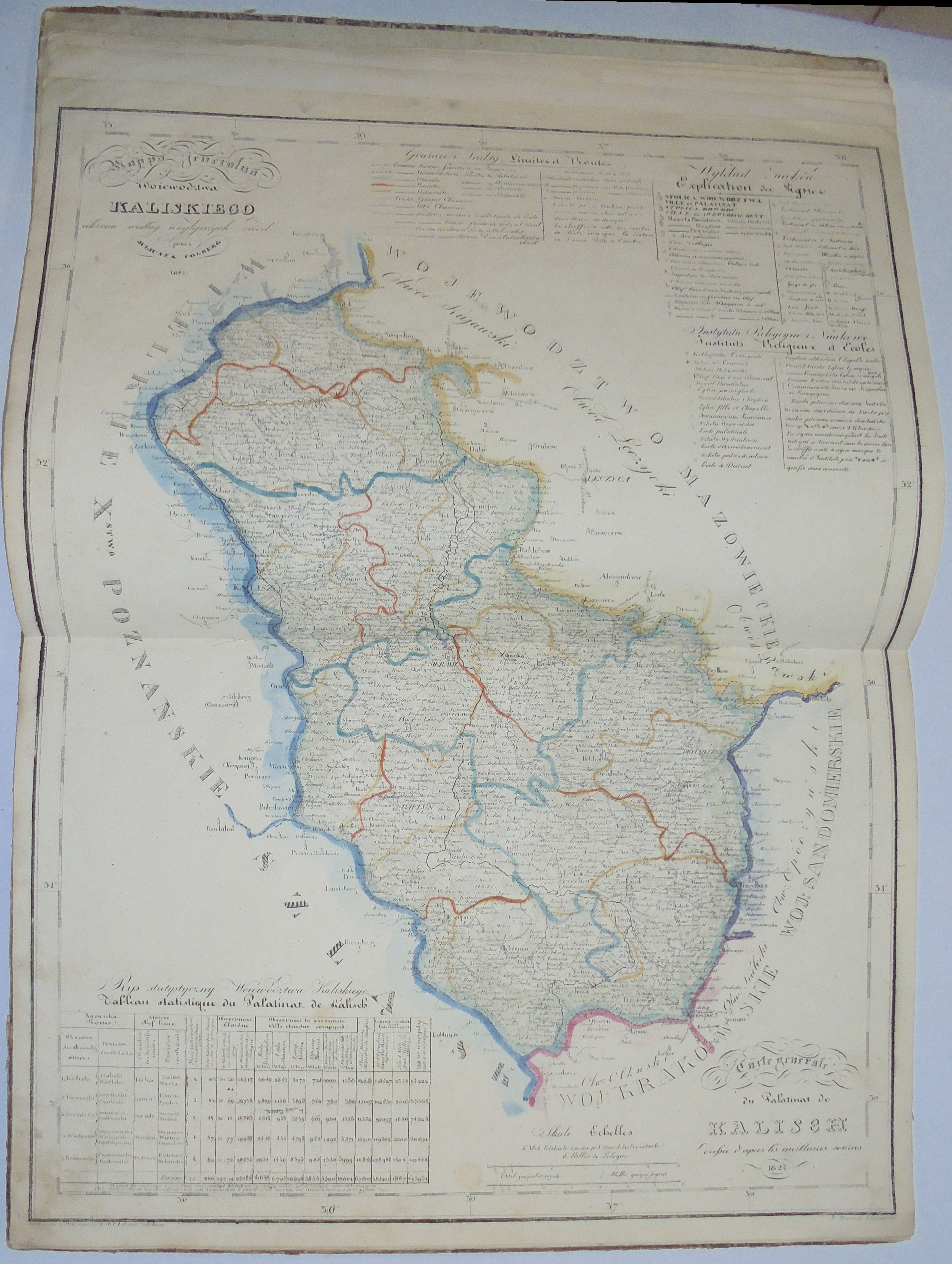
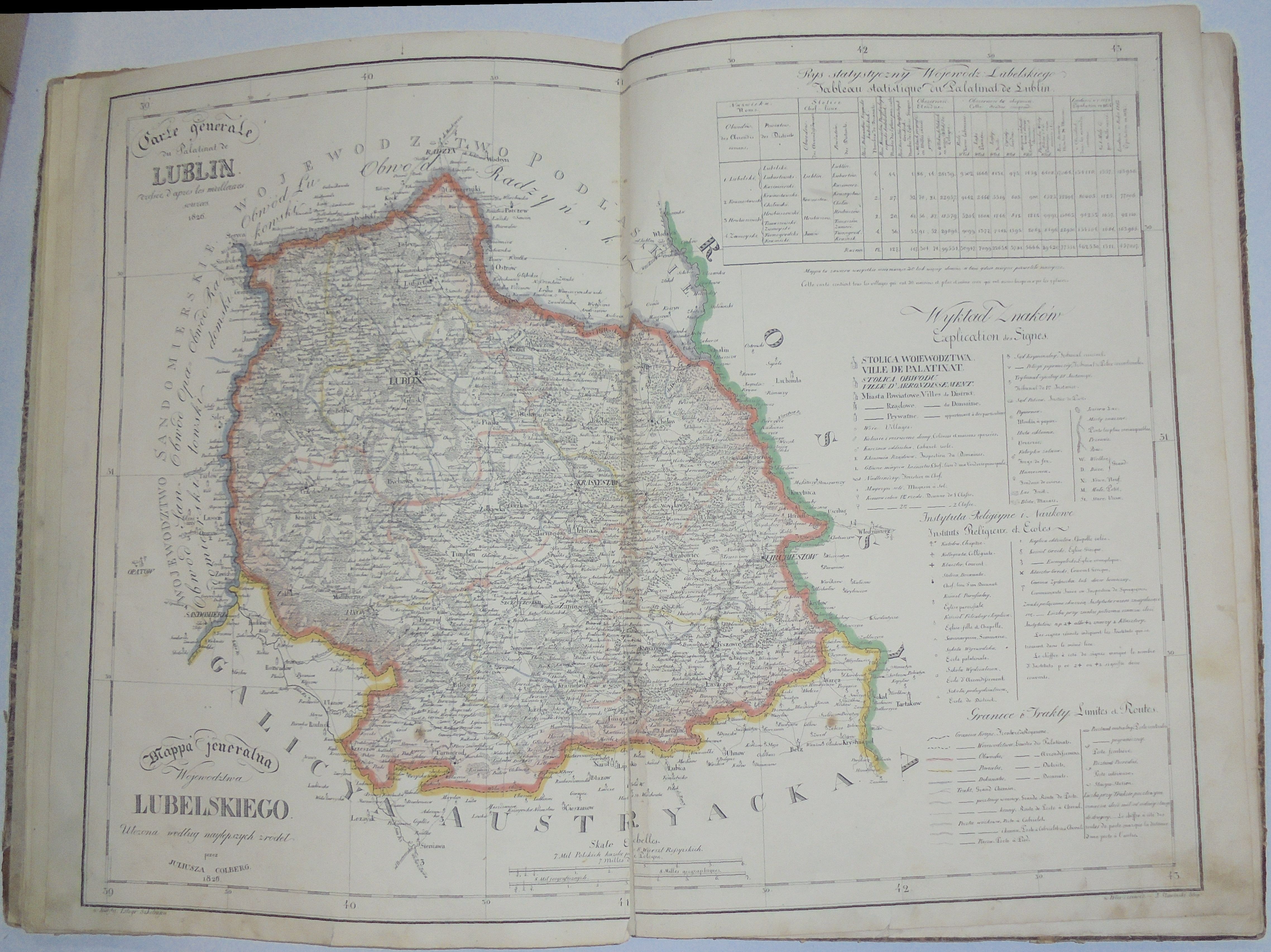
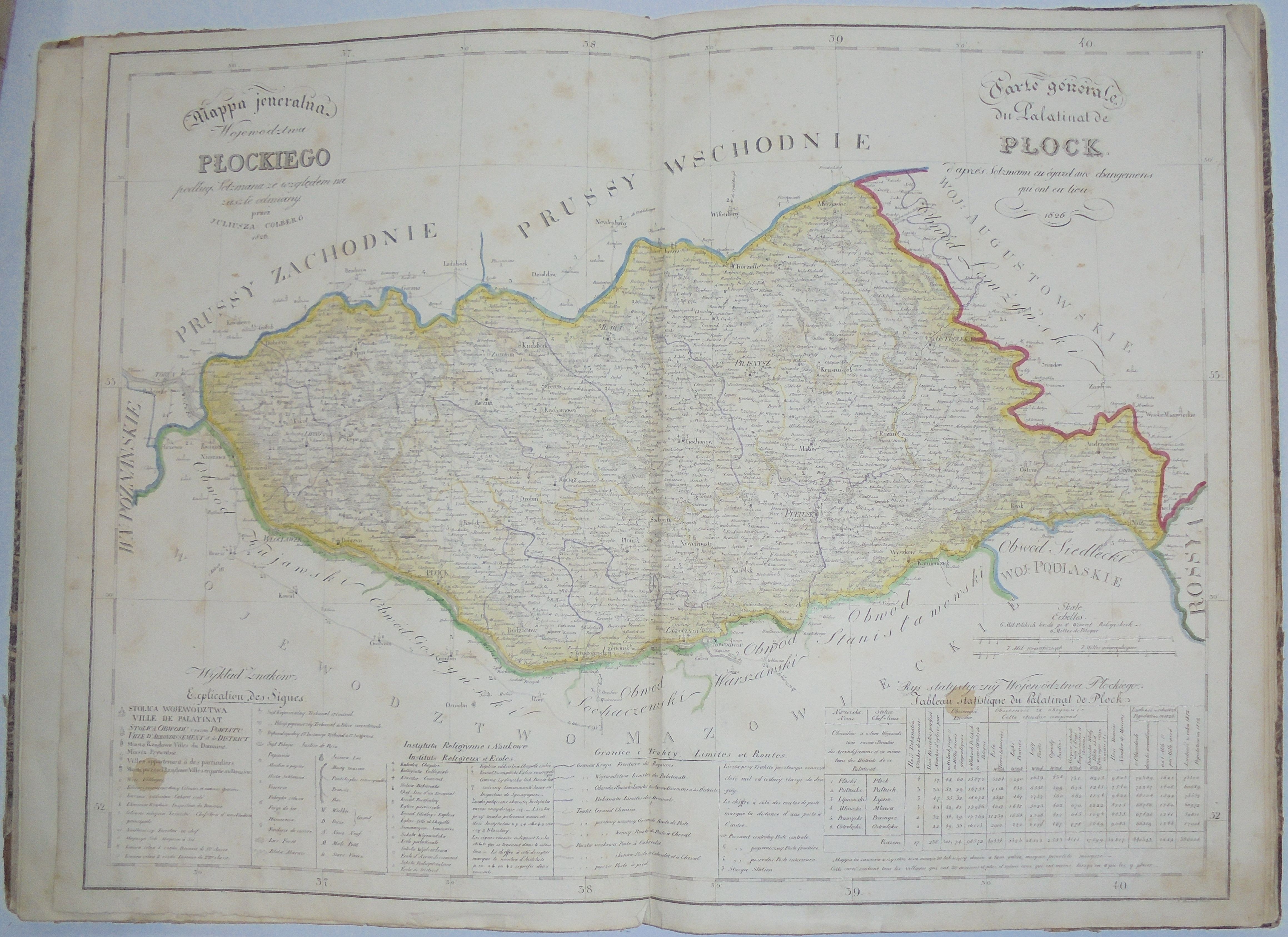
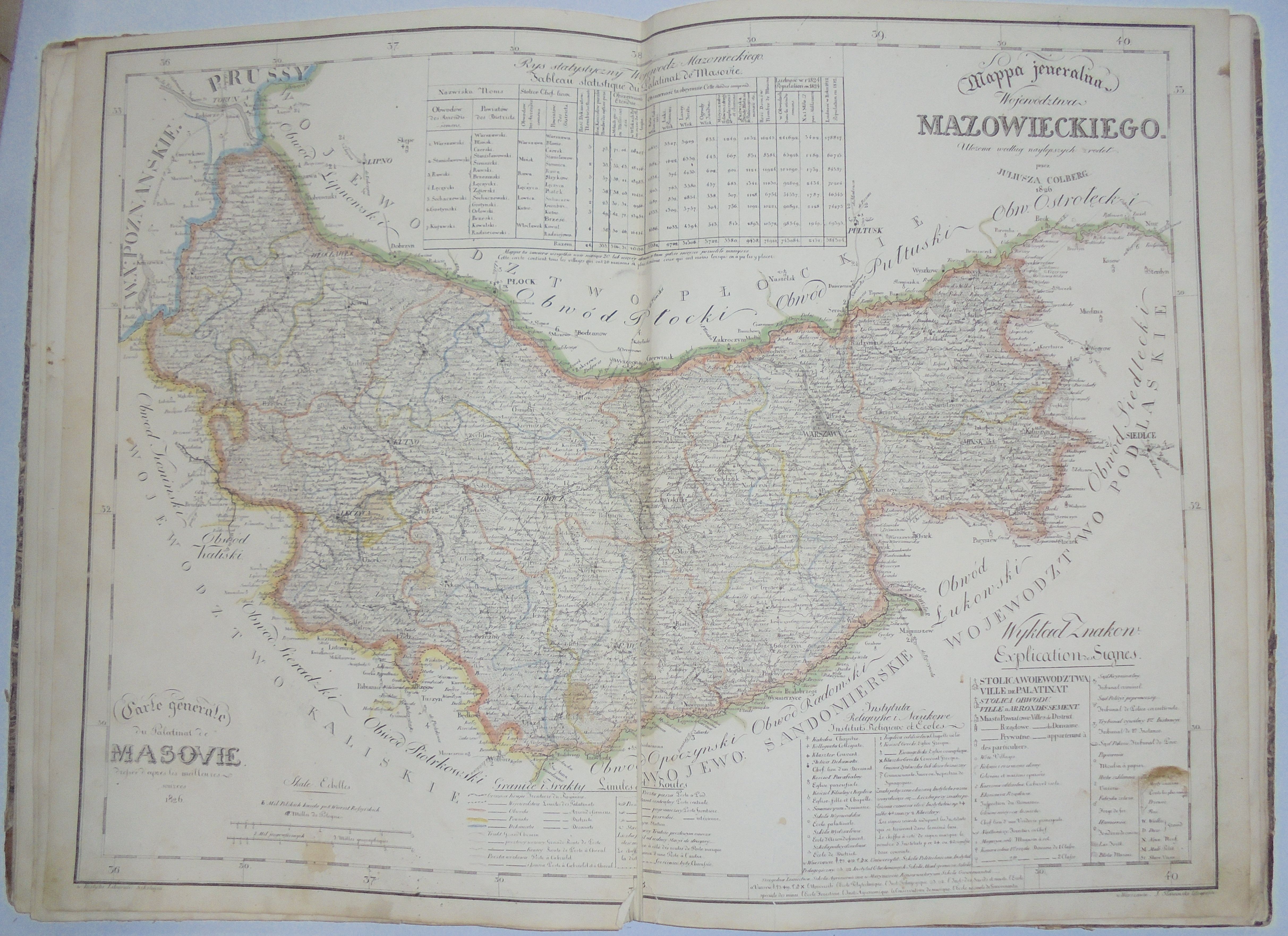
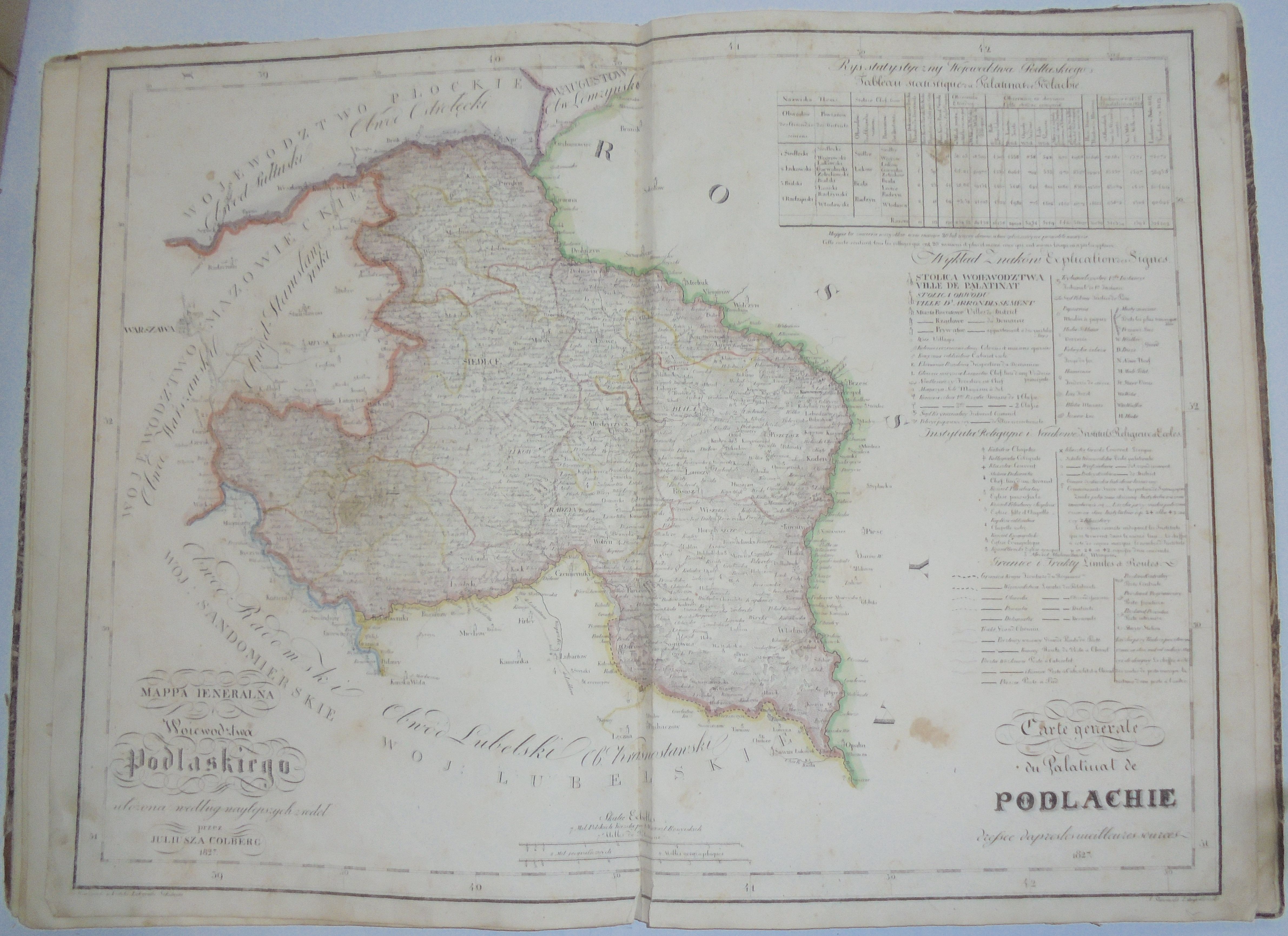
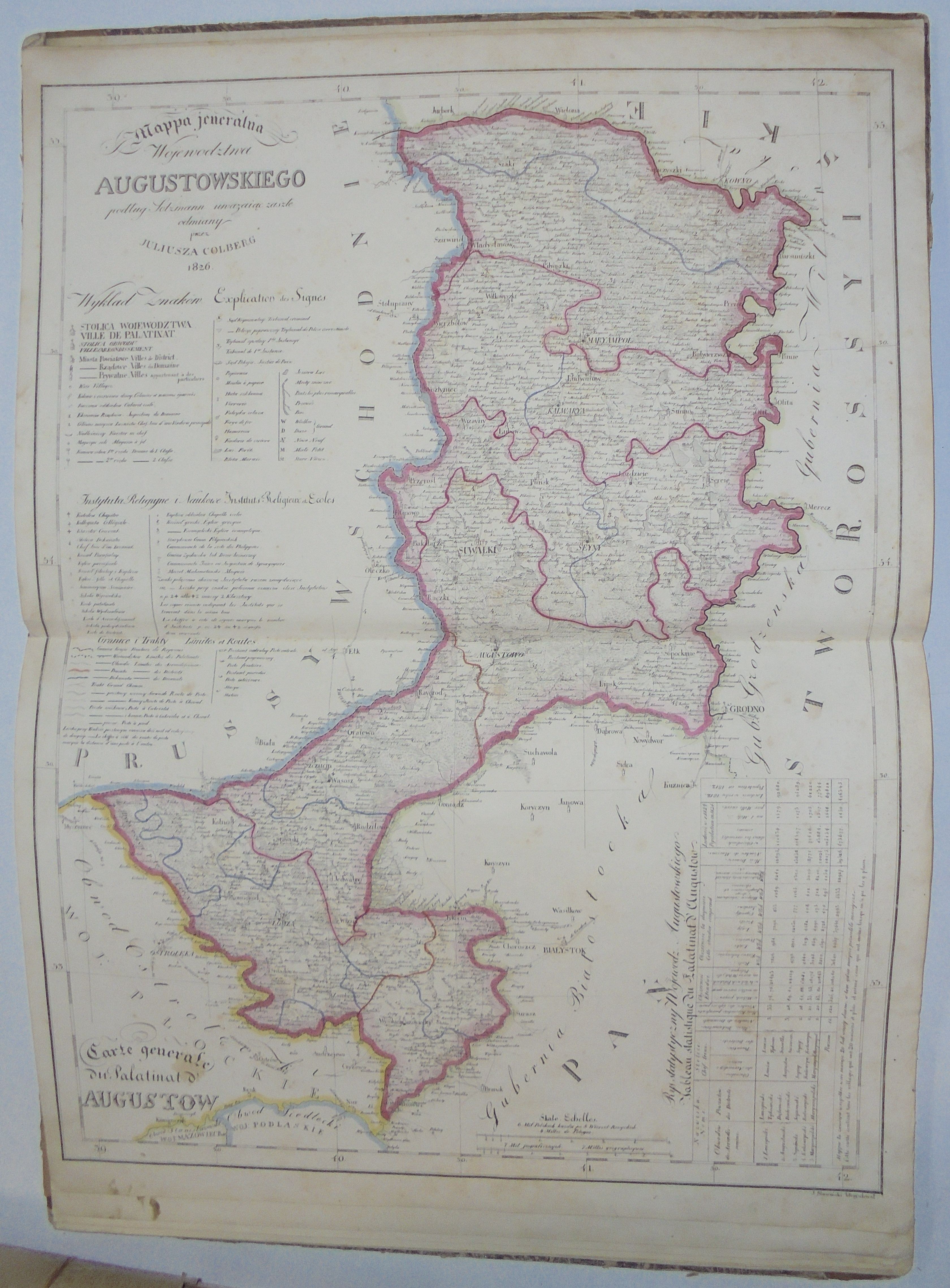
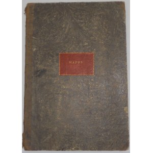
Cover of the volume titled "Mappy", inside a set of 8 maps of the provinces (successively: Kraków, Sandomierz, Kalisz, Lublin, Plock, Mazovia, Podlasie, Augustów), lithographs linearly colored in the period, and a bilingual, French-Polish, title page (on a loosely added, slightly smaller pinkish sheet) decorated with borders and coats of arms of the 8 provinces, which was engraved by Wilhelm Ruchacz, with a distributor's note: "sold at Store A. Dal Trozzo. Uli. Senatorska no. 496.".
Dimensions of atlas 45.4 x 31.6 cm, maps approx. 43 x 57 cm (slight variations depending on the map).
On the front pasteboard black stamp: Sąd Naywyższey Instancyi Król. Polish (active in 1815-1841).
Kolberg's maps were issued as loose sheets, which could be bought individually; only part of the edition was intended to be collected in atlas form. The first to go on sale was the Plock province (May 2, 1826.), the last to be issued were the Kalisz and Cracow provinces (Oct. 1, 1827). They were very popular, as late as October 1827 A.Dal Trozzo reported ("Kurier Warszawski" No. 293 of Wednesday, October 28, 1827) that the loose maps were nearing completion (he probably meant the latest maps of the Kalisz and Cracow provinces issued on October 1) and those interested in specific provinces, if they did not hurry, would have to purchase the entire atlases.
Their great accuracy meant that they were used for both private and official purposes, through frequent use they were quickly damaged, they often survived to our times with defects (several pieces of atlases have been digitized, e.g. for viewing on Polona.pl, among others, they are probably in even worse condition than the piece offered here), they all have damage, stains, etc...
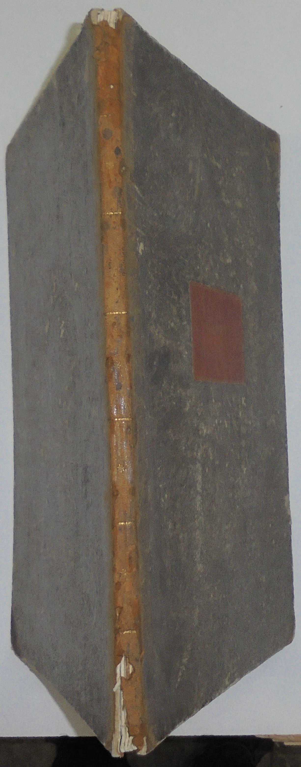
Condition: binding badly deteriorated, spine in half-leather with losses, frayed, cardboard veneer frayed with small losses and scratches. Inside maps with discoloration, soiling, staining, 3 maps with larger tears along folding, 1/4-1/2 in height (Sandomierz, Lublin, Mazovia provinces), 3 with smaller ones (Cracow, Plock, Podlasie provinces) minor few tears on margins of each map.
Bibliography:
Central Catalog of Cartographic Collections in Poland" zeszyt 5, PAN IGiPZ and Ossolineum, 1983, item 82.


![[MAP]. MAP OF POLAND 1 : 500 000. OLSZTYN. [Sheet ] 3. w-wa 1947....](https://img1.one.bid/img/6363/1859794_1x.webp?1713045600)


Recently viewed
Please log in to see lots list
Favourites
Please log in to see lots list