


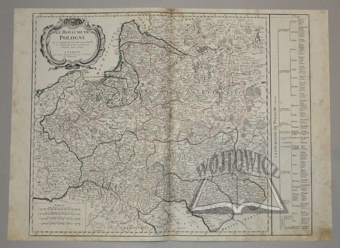
(POLAND). "Le Royaume de Pologne".
Par le S. Robert de Vaugondy Geog. ord. du Roi... A Venise (c. 1776). Ches Francois Santini rue S. Justine pres la dite Eglise. Line-colored copperplate including cartouche. Publisher: Paolo Santini. Engraver Francesco Santini. Map taken from atlas: "Atlas Universel dresse sur les meilleurs cartes". Venice ca. 1776. Dimensions: 48.5 x 60.7 cm (board: 51.3 x 68 cm).
On the back non. corner soiling. Very good condition. A framed table with the territorial division of the Republic added to the map: "La Couronne De Pologne comprend". Decorative information cartouche in upper left corner. (Imago Poloniae K48/11).


Recently viewed
Please log in to see lots list
Favourites
Please log in to see lots list