


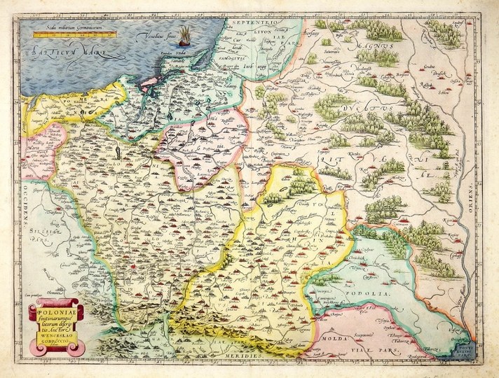
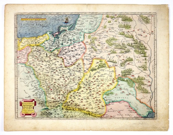
[POLAND]. Poloniae finitimarumque locorum descriptio. Auctore Wenceslao Godreccio, Polono. Copperplate colored engraving form. 37.4x49.7 cm.
Imago Pol. K7/1; Kublin 20. Map of Poland by Waclaw Grodecki from the Latin edition of Abraham Ortelius' atlas "Theatrum Orbis Terrarum" published in Antwerp in 1573. First state of plate used since 1570 (e.g., the name of the Gwda River was not changed, Byczyna was not added). Title in ferrule cartouche in lower left corner, single linear scale in upper left corner. A single sailing ship on the Baltic. On the back right Latin text "Poloniae Regnvm" in 53 lines ending in a stepped line and pag. 58. line and surface color. Local browning of margins, minor staining.


![Poland car map. Cracow [1945].](https://img1.one.bid/img/6508/1873705_1x.webp?1713823200)
![Poland car map. Cracow [1945].](https://img1.one.bid/img/6508/1873705_2x.webp?1713823200)


![[MAP]. MAP OF POLAND 1 : 500 000. OLSZTYN. [Sheet ] 3. w-wa 1947....](https://img1.one.bid/img/6363/1859794_1x.webp?1713045600)


Recently viewed
Please log in to see lots list
Favourites
Please log in to see lots list