


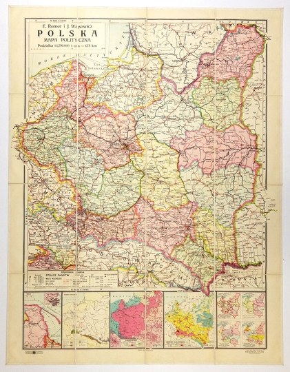
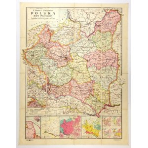
[POLAND]. Poland. Political map. Color map form. 89.2x65.4 cm.
Map of Poland compiled by Eugeniusz Romer and Jozef Wąsowicz, published in Lvov and Warsaw by Ksiaznica-Atlas in 1934. Title in box in upper left corner, scale there (1:2,500,000), linear and appointed scales. In the lower left corner a legend, above it a side map of the coal district. Under the main map, 4 larger side maps (Sea, Fossil Fodder, Nationalities, Population Density) and 4 smaller ones (Roman Catholic Church, Education, Judiciary, Railroad and Post Office). Map cut in period into 16 parts glued together on linen and equipped with linen case. Very good condition.


![[MAP]. MAP OF POLAND 1 : 500 000. OLSZTYN. [Sheet ] 3. w-wa 1947....](https://img1.one.bid/img/6363/1859794_1x.webp?1713045600)


Recently viewed
Please log in to see lots list
Favourites
Please log in to see lots list