


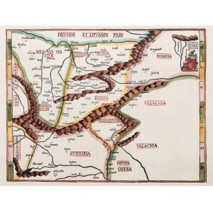
Map of Central Europe (Poland, Russia, Hungary, Transylvania), taken from Claudius Ptolemy's work "Geographia", published by Johannes Grüninger, Strasbourg, 1525
colored woodcut, 29.5 x 39.6 cm; framed
very good condition
Imago Poloniae, K3/2


Recently viewed
Please log in to see lots list
Favourites
Please log in to see lots list