


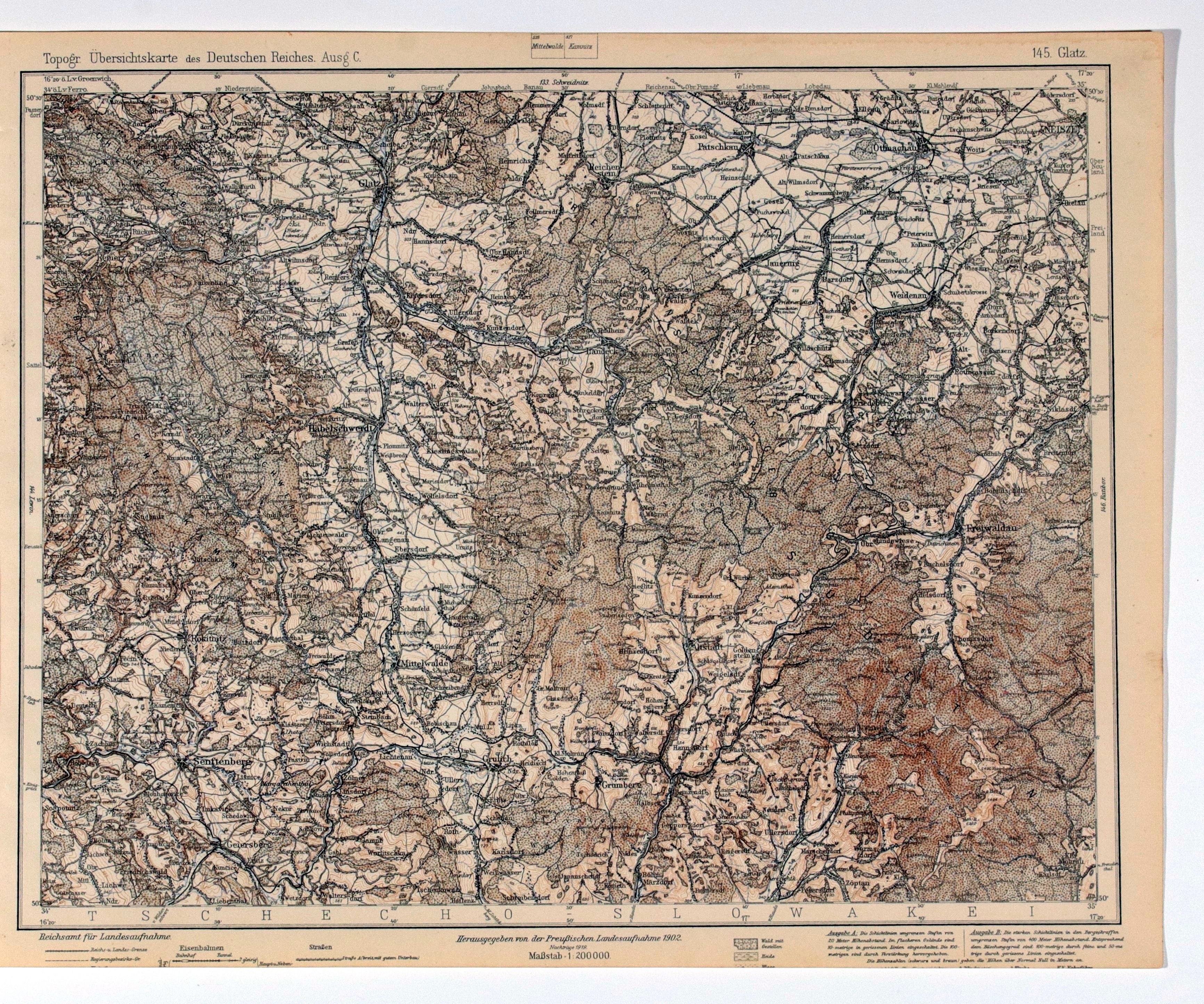
KŁODZKO. Topographical map of the Kłodzko area; map also includes: Nysa, Otmuchów, Paczków; taken from Topogr. Übersichtskarte..., scale 1 : 200 000, compiled. 1902, published by Preussische... , 1919; partly in color; st. db., bottom part trimmed; dimensions ca. 408x318 mm; 145. Glatz.


![[MAP]. MAP OF POLAND 1 : 500 000. OLSZTYN. [Sheet ] 3. w-wa 1947....](https://img1.one.bid/img/6363/1859794_1x.webp?1713045600)


Recently viewed
Please log in to see lots list
Favourites
Please log in to see lots list