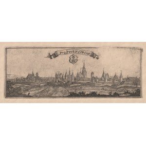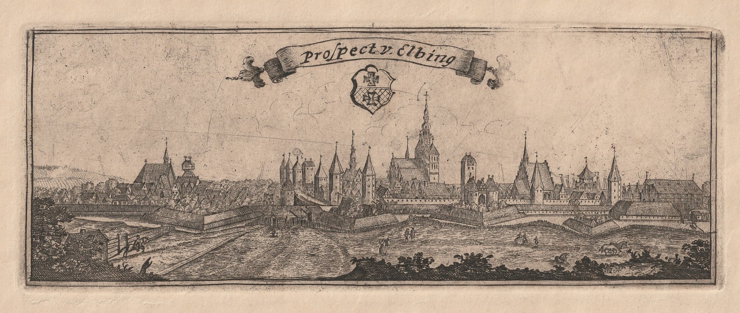
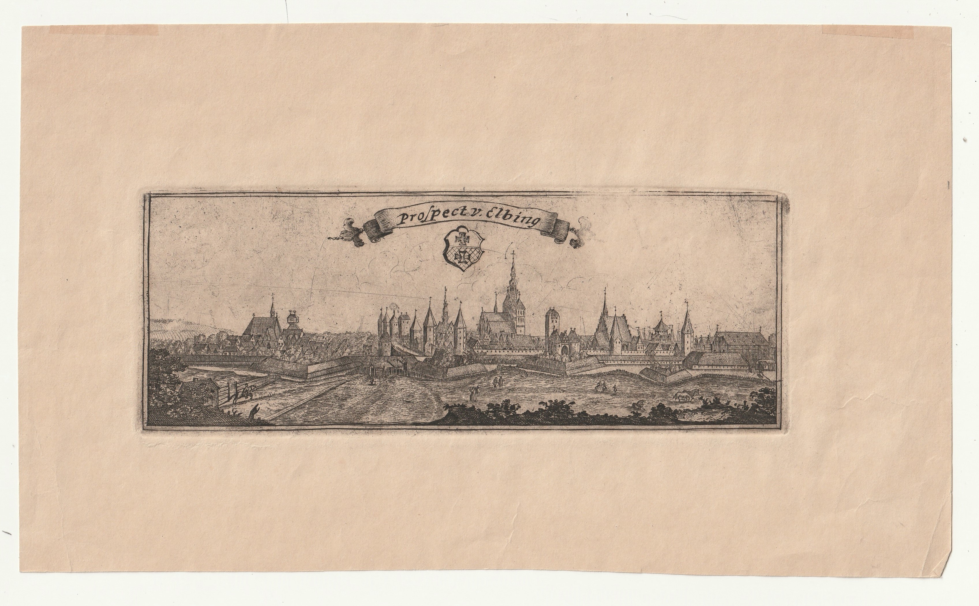
ELBLĄG. Panorama of the city from the northeast; drawn and engraved by. J.F. Endersch, before 1746; copper b/w, st. bdb; plate dimensions 193x73 mm; title on wavy ribbon: Prospect v. Elbing.
A later, most likely 19th century print from the original plate. The panorama appeared as a separate publication in a few pieces. Realistic and detailed representation - visible Market Gate, Epiphany Church, St. Nicholas Church, buildings of the new and old town. See M. Toeppen, Geschichte der räumlicher Ausbreitung der Stadt Elbing, p. 35.
Jan Frederick Endersch (1705-1769) - a mathematician and cartographer from Thuringia, spent most of his life in Elblag (Royal Prussia). He made globes; he donated two of them to King August III. For this he received a patent and the title of royal mathematician in 1750. He was interested in the heliocentric theory of Nicolaus Copernicus and developed a model of the solar system according to this theory. In 1755 he made a map of Warmia commissioned by Bishop Adam Stanislaw Grabowski and published in Elblag. He also made a map of Zulawy Wislane and a plan of the Nogat River near Elblag. He participated in the preparation of the first atlas of the Polish lands, Carte de Pologne [...] (1772), published by Rizzi Zannoni.