


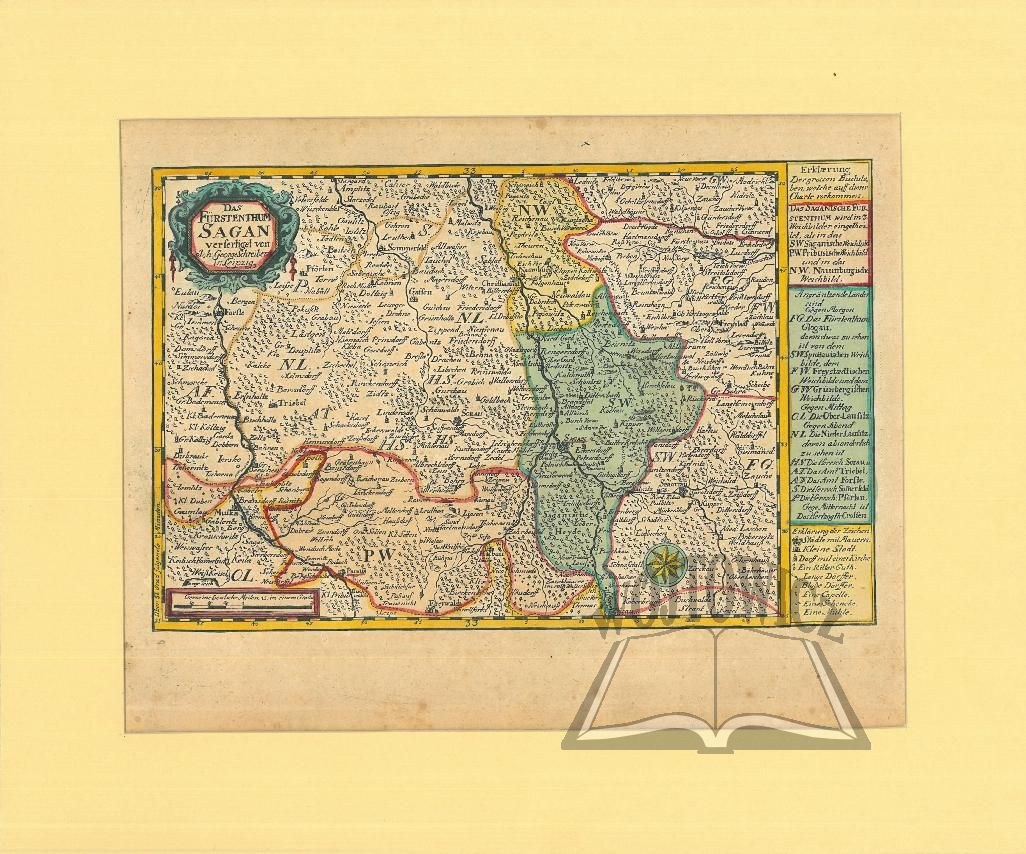
(ZAGAN). "Das Fürstenthum Sagan verfertiget von...
Colored copperplate. The map comes from an atlas: J[ohann] G[eorg] Schreibern - "Atlas Selectus von allen Königreichen und Ländern der Welt zum bequemen Gebrauch in Schulen, auf Reisen und bei dem Lesen der Zeitungen". Leipzig (ca. 1749). Format: 15.2 x 23.5 cm (board: 21.5 x 28.5 cm). Graphic in passe-partout, overall: 28 x 33.5 cm.
Good condition. Traces of non. Rust stains. Decorative title cartouche in upper left corner, scale below; in right margin outside frame legend explaining administrative division. Żagań in Lubuskie province.


![Königl. Freistadt Oedenburg [Sopron szabad királyi város térképe, 1871.] Lithographiert von F. Szita. W[iene]r...](https://img1.one.bid/img/6570/1844246_1x.webp?1712700000)
![Königl. Freistadt Oedenburg [Sopron szabad királyi város térképe, 1871.] Lithographiert von F. Szita. W[iene]r...](https://img1.one.bid/img/6570/1844246_2x.webp?1712700000)


Recently viewed
Please log in to see lots list
Favourites
Please log in to see lots list