


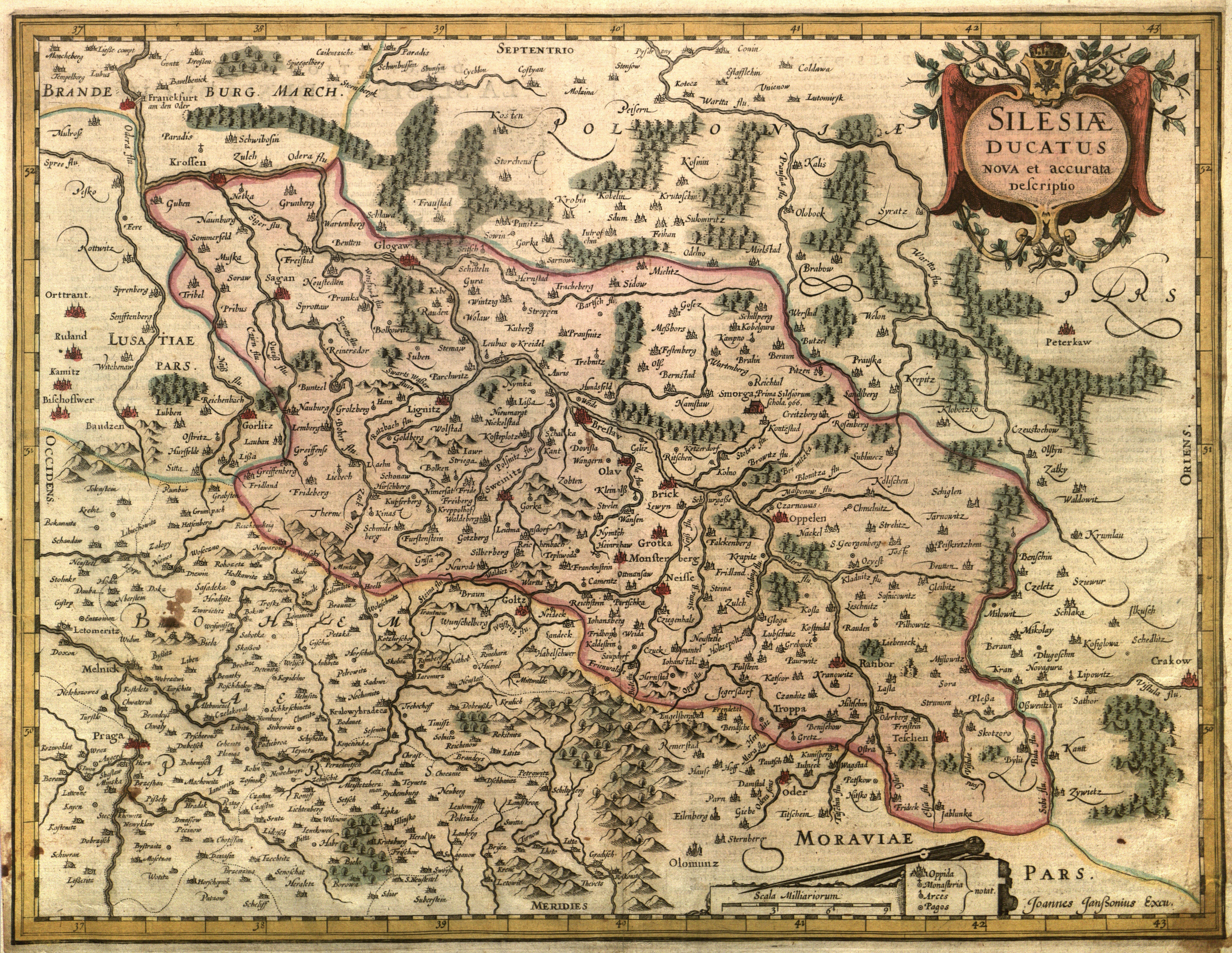
SLĄSK. Map of Silesia; published by J. Janssonius, taken from: Atlas Novus, ca. 1630; title cartouche surmounted by the Silesian coat of arms and the duke's mitre; signed at bottom: Joannes Janssonius Excu., explanation of four signs and scale; on verso text: DESCRIPTION DE TOVTE LA SLESIE, ET DE SES DVCHEZ; copper col., st. bdb., after conservation, completed right margin, soiling; sheet dimensions approx. 515x440mm; SILESIAE DUCATUS NOVA et accurata descriptio.


![[MAP]. MAP OF POLAND 1 : 500 000. OLSZTYN. [Sheet ] 3. w-wa 1947....](https://img1.one.bid/img/6363/1859794_1x.webp?1713045600)


Recently viewed
Please log in to see lots list
Favourites
Please log in to see lots list