


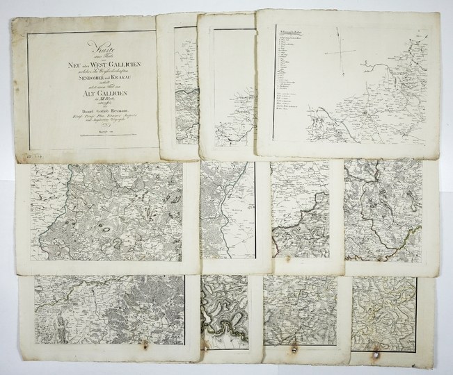
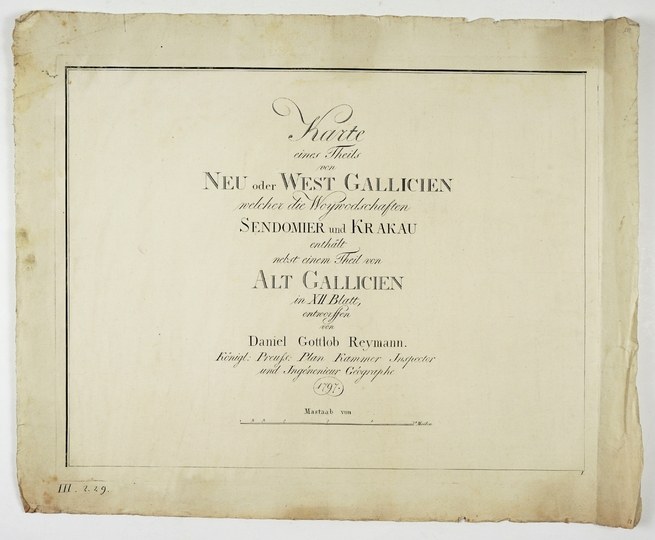
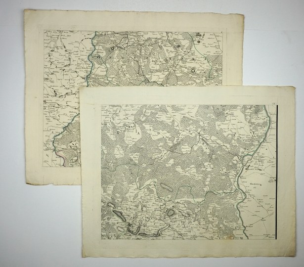
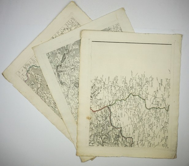
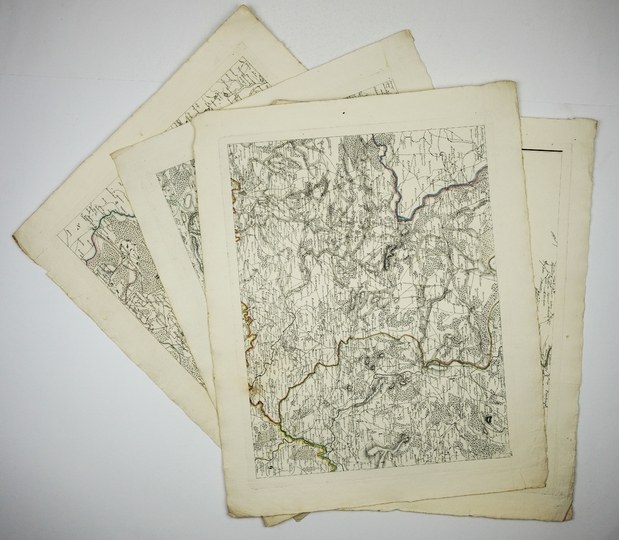
[GALICIA]. Karte eines Theils von Neu oder West Gallicien welcher die Woywodschaften Sendomier und Krakau enthält nebst einem Theil von Alt Galicien in XII Blatt, entworffen von Daniel Gottlob Reymann [...]. Title sheet and 11 maps in colored copperplate form. 38.5x49.9 cm each.
CKZK 5, 28. Very detailed map of Galicia published in 1797 Berlin by S. Schropp in comp. D. G. Reymann partly according to a manuscript map made by F. Czajkowski. The place of publication and publisher are not revealed on the map. Line color. Covers the area: Czersk-Dukla, Cieszyn-Lańcut. Loose maps. Small folds and tears of margins, on last 5 sheets increasing loss and browning of lower margin on map border, small loss (ca 3x1.5 cm) within map. Infrequent.


![[MAP]. MAP OF POLAND 1 : 500 000. OLSZTYN. [Sheet ] 3. w-wa 1947....](https://img1.one.bid/img/6363/1859794_1x.webp?1713045600)
![Poland car map. Cracow [1945].](https://img1.one.bid/img/6508/1873705_1x.webp?1713823200)
![Poland car map. Cracow [1945].](https://img1.one.bid/img/6508/1873705_2x.webp?1713823200)


![Dalhberg Erik Jonsson [Puffendorf] - Map of the Kingdom of Denmark and Pomerania (Szczecin)](https://img1.one.bid/img/5856/1829209_1x.webp?1712008800)
![Dahlberg Erik Jonsson [Puffendorf] - Battle of Filipovo on October 12 (22), 1656.](https://img1.one.bid/img/5856/1829249_1x.webp?1712008800)


Recently viewed
Please log in to see lots list
Favourites
Please log in to see lots list