


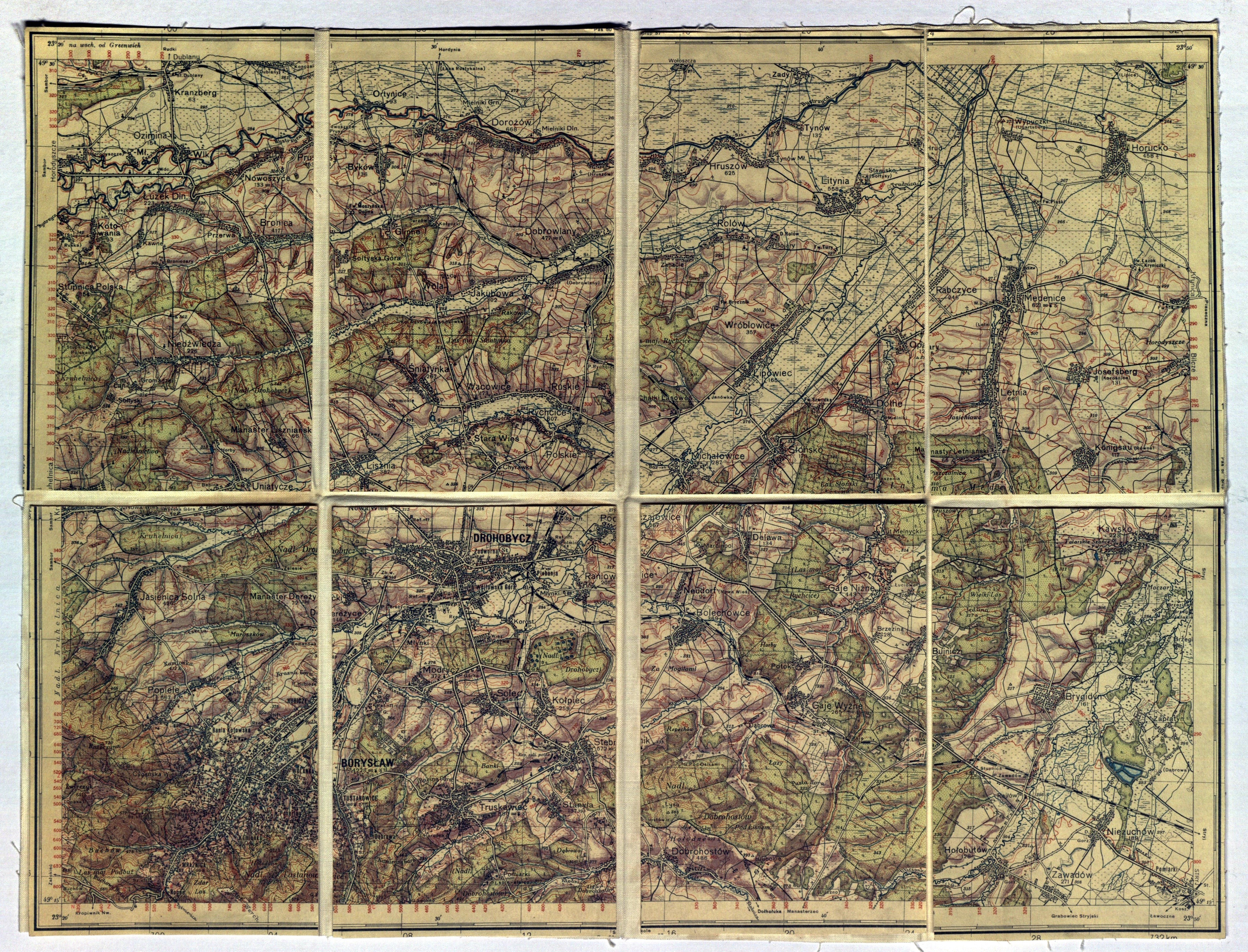
OIL BASIN. BORYSLAV, DROHOBYCH (UKRAINE). Topographical map of the area around Boryslav and Drohobych, the Bystrzyca River (right tributary of the Dniester) in the north, the Truskavets in the south, pre-1939 edition, color, divided into 8 parts glued with linen; f.p.; dimensions ca. 402x302mm; no tit .


Recently viewed
Please log in to see lots list
Favourites
Please log in to see lots list