


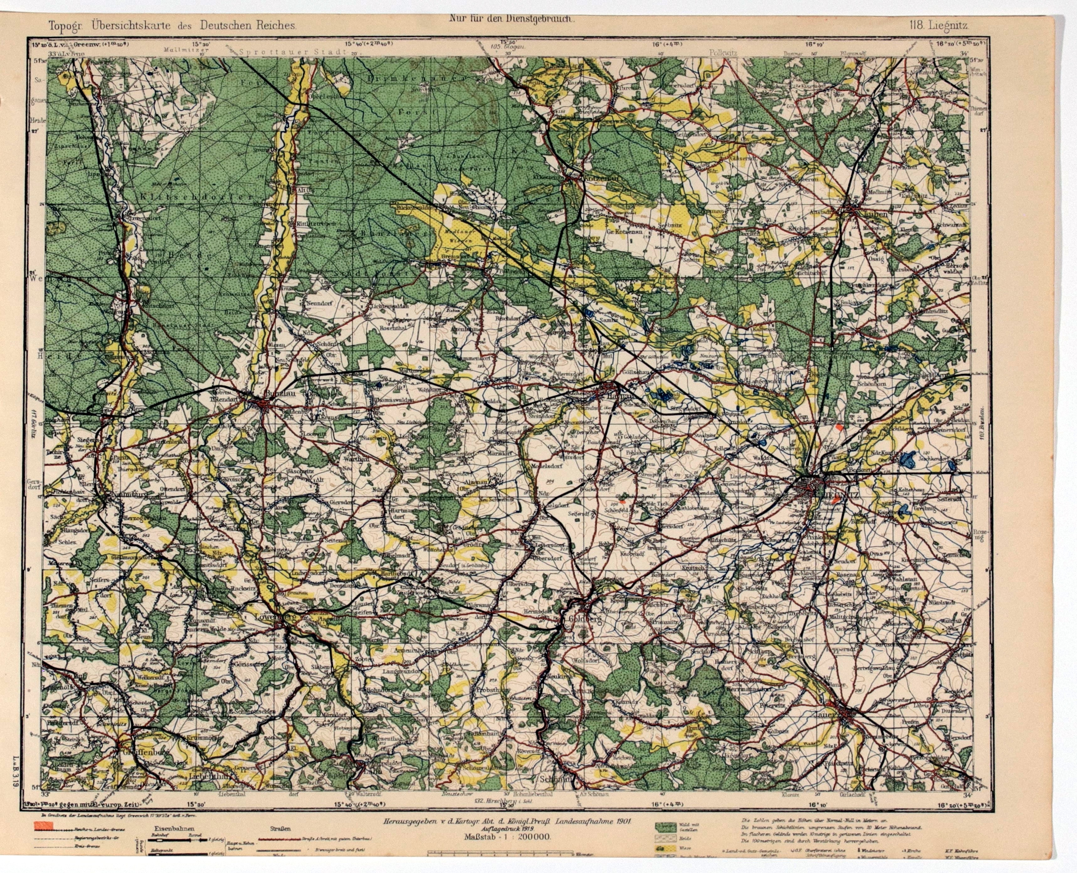
LEGNICA. Topographical map of the Legnica area, the map also includes: Zlotoryja, Jawor, Chojnów; derived from Topogr. Übersichtskarte..., scale 1 : 200 000, compiled. 1901, published by Reichsamt..., 1919; color; st. db., bottom portion trimmed; dimensions approx. 408x318 mm; 118. Liegnitz.


![[MAP]. MAP OF POLAND 1 : 500 000. OLSZTYN. [Sheet ] 3. w-wa 1947....](https://img1.one.bid/img/6363/1859794_1x.webp?1713045600)


Recently viewed
Please log in to see lots list
Favourites
Please log in to see lots list