


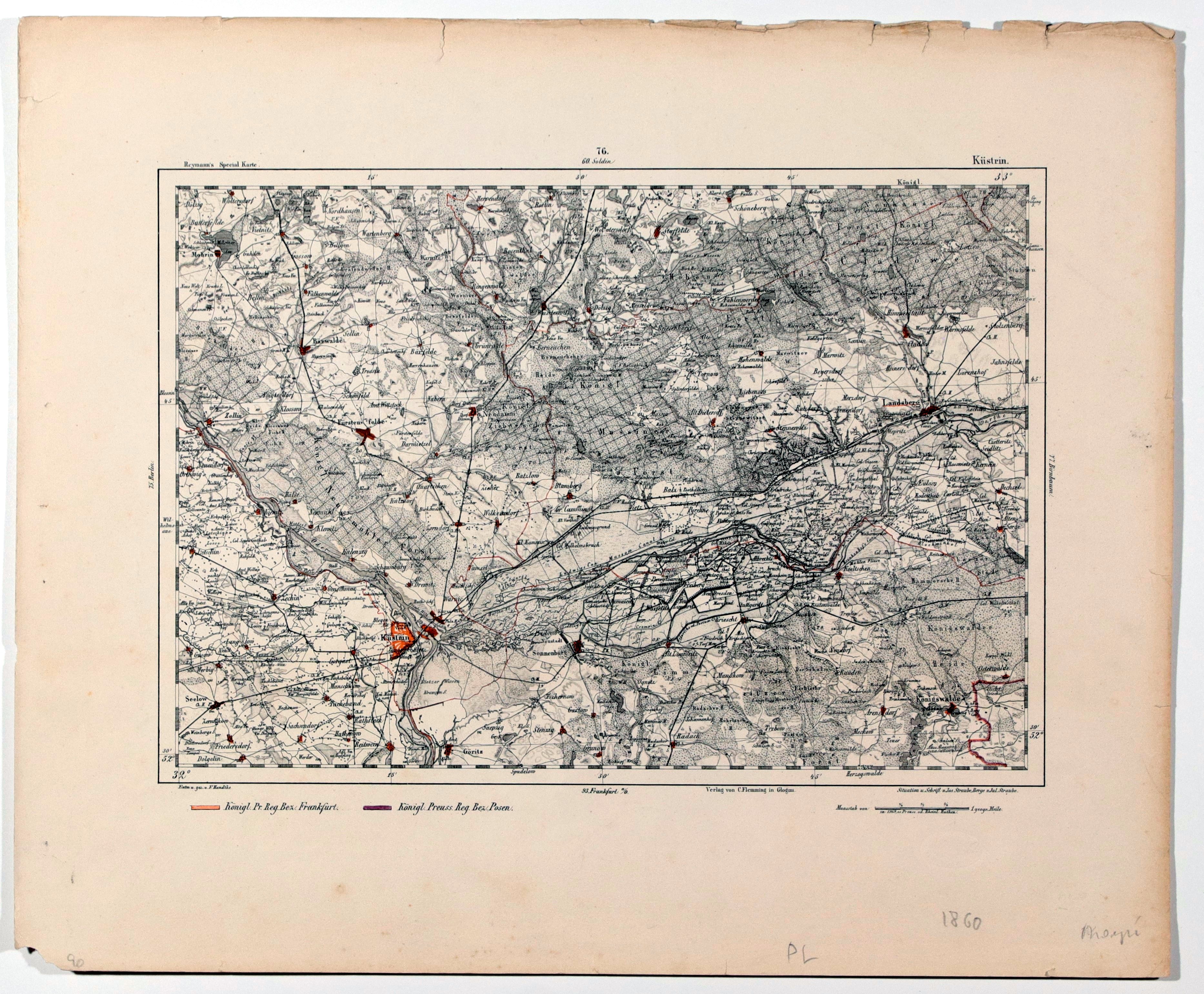
KOSTRZYN NAD ODRĄ, GORZOW. Topographical map of the area around Kostrzyn nad Odrą and Gorzow Wielkopolski, section 76; b/w with line color; edges worn; b. tit.
Daniel Gottlob Reymann was a military cartographer in the Prussian army. Like Weiland of the Geographical Institute in Weimar, he undertook work on the type of maps with a great deal of topographical detail needed for any army wishing to conduct warfare. His first studies appeared in 1806. They were used in the ongoing Napoleonic-Prussian war in 1806/07. He successively created more until his death in 1837, and managed to compile 142 maps. His continuators expanded the collection to as many as 330 maps. In 1846 the rights to these maps were taken over by Carl Flemming's Glogow outhouse, which published them until 1874. Later the rights to them were bought by the General Staff of the Prussian Army, which printed them until 1908. Reymann's maps also provided cartographic support for the German army's topographic maps during World War I. All maps were rebound from a 355x250mm steel plate. They usually have preserved original margins, condition of all generally bdb. Drawn by Handtke et al.


![[MAP]. MAP OF POLAND 1 : 500 000. OLSZTYN. [Sheet ] 3. w-wa 1947....](https://img1.one.bid/img/6363/1859794_1x.webp?1713045600)
![Poland car map. Cracow [1945].](https://img1.one.bid/img/6508/1873705_1x.webp?1713823200)
![Poland car map. Cracow [1945].](https://img1.one.bid/img/6508/1873705_2x.webp?1713823200)


![Dalhberg Erik Jonsson [Puffendorf] - Map of the Kingdom of Denmark and Pomerania (Szczecin)](https://img1.one.bid/img/5856/1829209_1x.webp?1712008800)


