


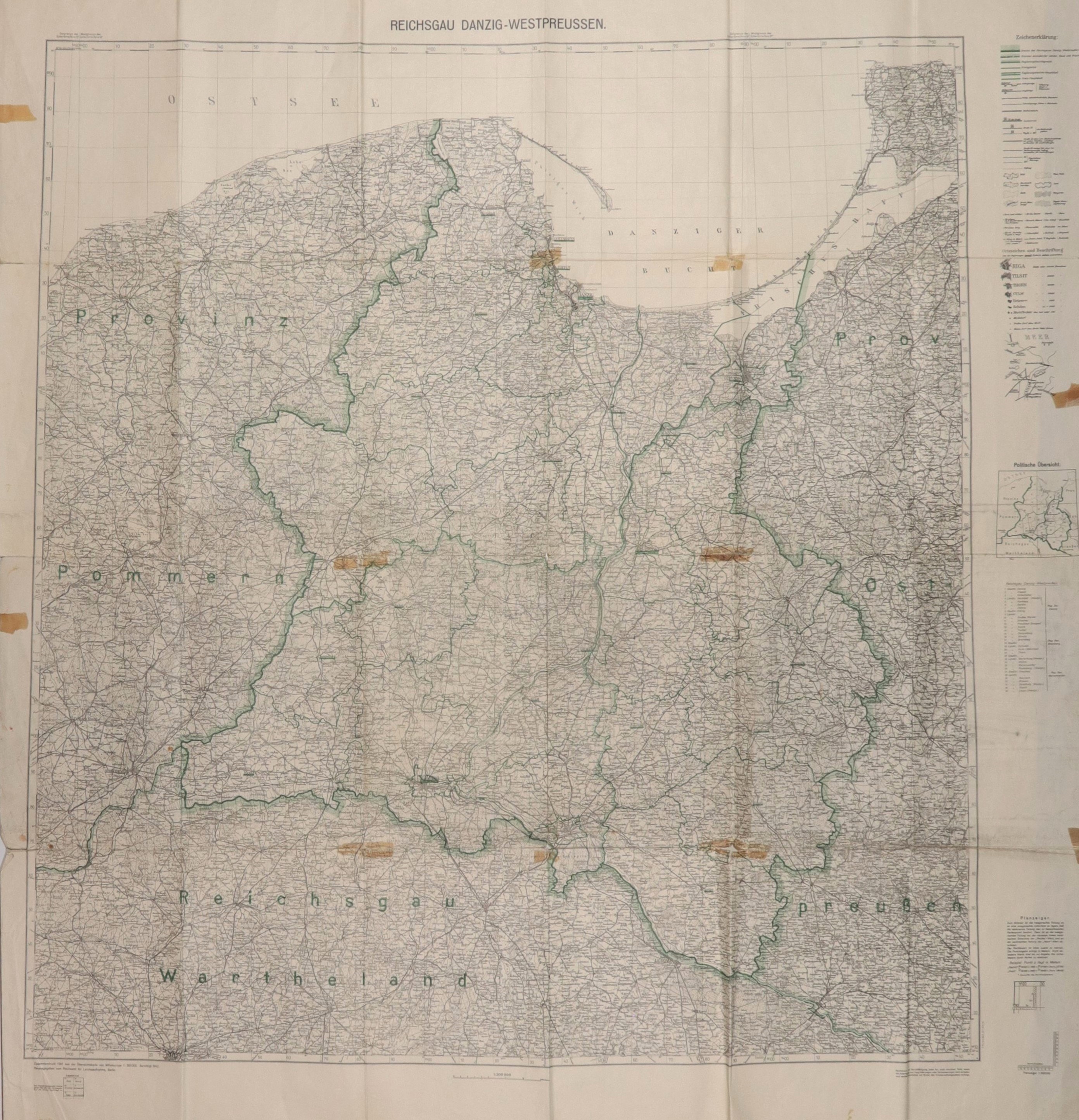
GDAŃSK. map of the Reich District of Danzig-West Prussia, created in 1939, taken from: Übersichtskarte von Mitteleuropa, published by Reichsamt..., Berlin 1941; scale 1 : 300,000; legend on the right p.; printed in black and white with line color; st. bdb., multiple folds, light creases, minimal tears and rubbing on the folds, on verso traces of under-gluing; sheet dimensions: 1050x1150 mm; REICHSGAU DANZIG-WESTPREUSSEN.


![[MAP]. MAP OF POLAND 1 : 500 000. OLSZTYN. [Sheet ] 3. w-wa 1947....](https://img1.one.bid/img/6363/1859794_1x.webp?1713045600)


![Poland car map. Cracow [1945].](https://img1.one.bid/img/6508/1873705_1x.webp?1713823200)
![Poland car map. Cracow [1945].](https://img1.one.bid/img/6508/1873705_2x.webp?1713823200)


Recently viewed
Please log in to see lots list
Favourites
Please log in to see lots list