


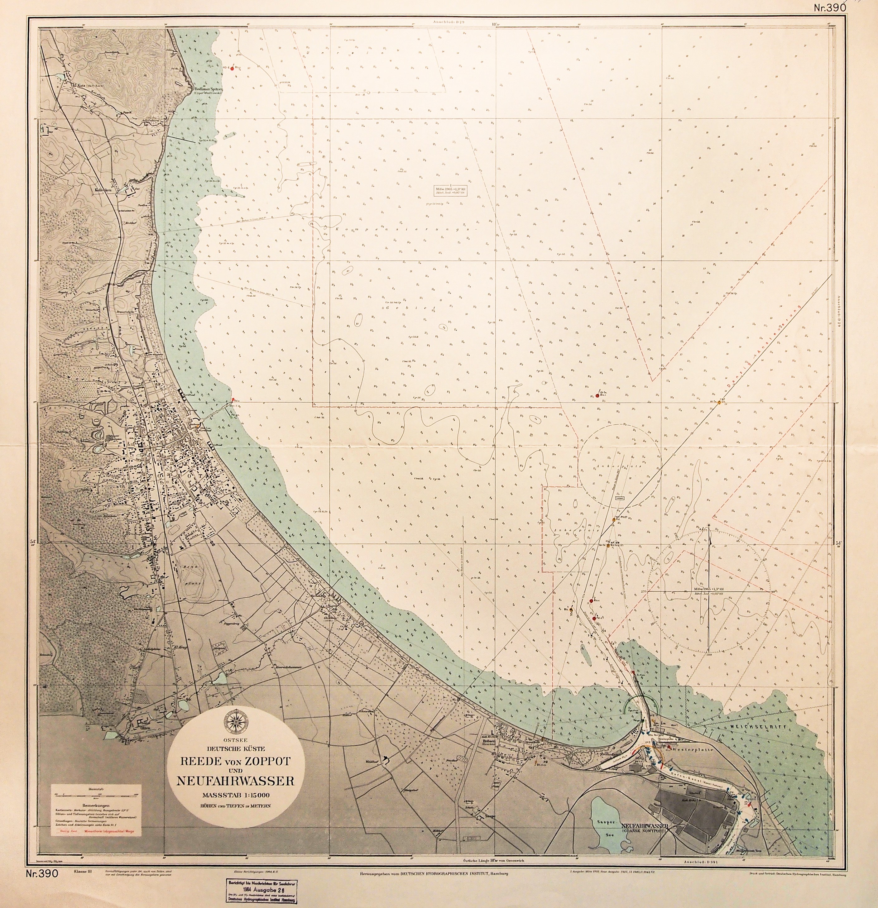
GDANSK BAY. Navigational map of part of the Gulf of Danzig with plan of the New Port and Sopot; Hamburg 1964; outdated ownership stamp in upper right corner; color print, st. bdb., fold mark; map dimensions: 738x768 mm; Ostsee, Deutsche Küste, Reede von Zoppot und Neufahrwasser.


![[MAP]. MAP OF POLAND 1 : 500 000. OLSZTYN. [Sheet ] 3. w-wa 1947....](https://img1.one.bid/img/6363/1859794_1x.webp?1713045600)


Recently viewed
Please log in to see lots list
Favourites
Please log in to see lots list