


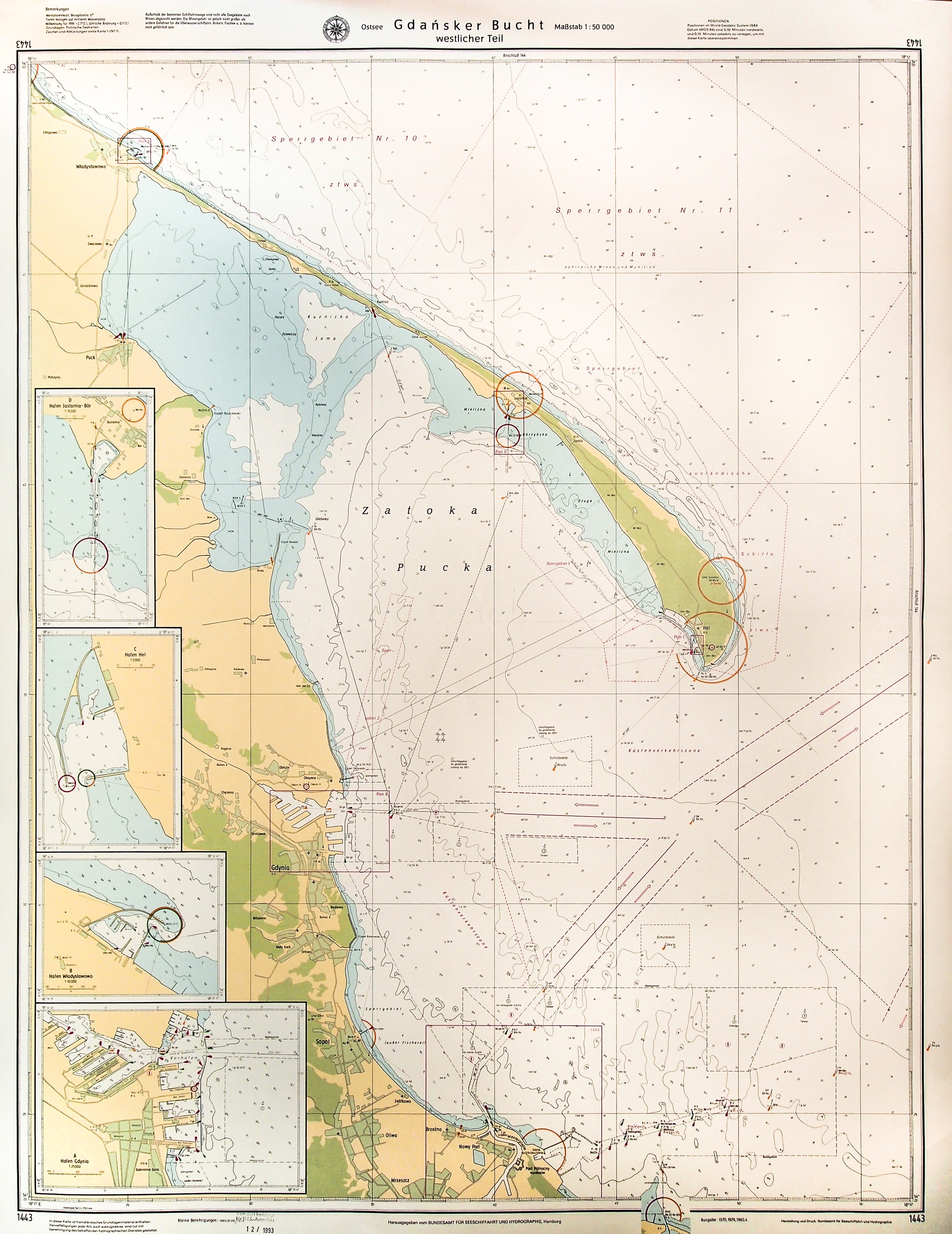
GDANSK BAY. Navigational map of the Gulf of Gdansk with New Port, Sopot, Gdynia and Hel Spit; Hamburg 1992; left p. 4 frames with more detailed maps of the ports of Jastarnia, Hel, Wladyslawowo and Gdynia; on verso out-of-date ownership stamp, handwritten corrections; color print, fine condition, fold mark; map dimensions: 750x962 mm. Ostsee, Danziger Bucht, westlicher Teil.


![Dahlberg Erik Jonsson [Puffendorf] - New fortifications of the city of Regiomontis](https://img1.one.bid/img/5856/1830502_1x.webp?1712095200)
![Dahlberg Erik Jonsson [Puffendorf] - Plan of the Baltic coast, from Danzig and Vistula to the spit of Hel](https://img1.one.bid/img/5856/1829282_1x.webp?1712008800)
![[MAP]. MAP OF POLAND 1 : 500 000. OLSZTYN. [Sheet ] 3. w-wa 1947....](https://img1.one.bid/img/6363/1859794_1x.webp?1713045600)
![Poland car map. Cracow [1945].](https://img1.one.bid/img/6508/1873705_1x.webp?1713823200)
![Poland car map. Cracow [1945].](https://img1.one.bid/img/6508/1873705_2x.webp?1713823200)


Recently viewed
Please log in to see lots list
Favourites
Please log in to see lots list