


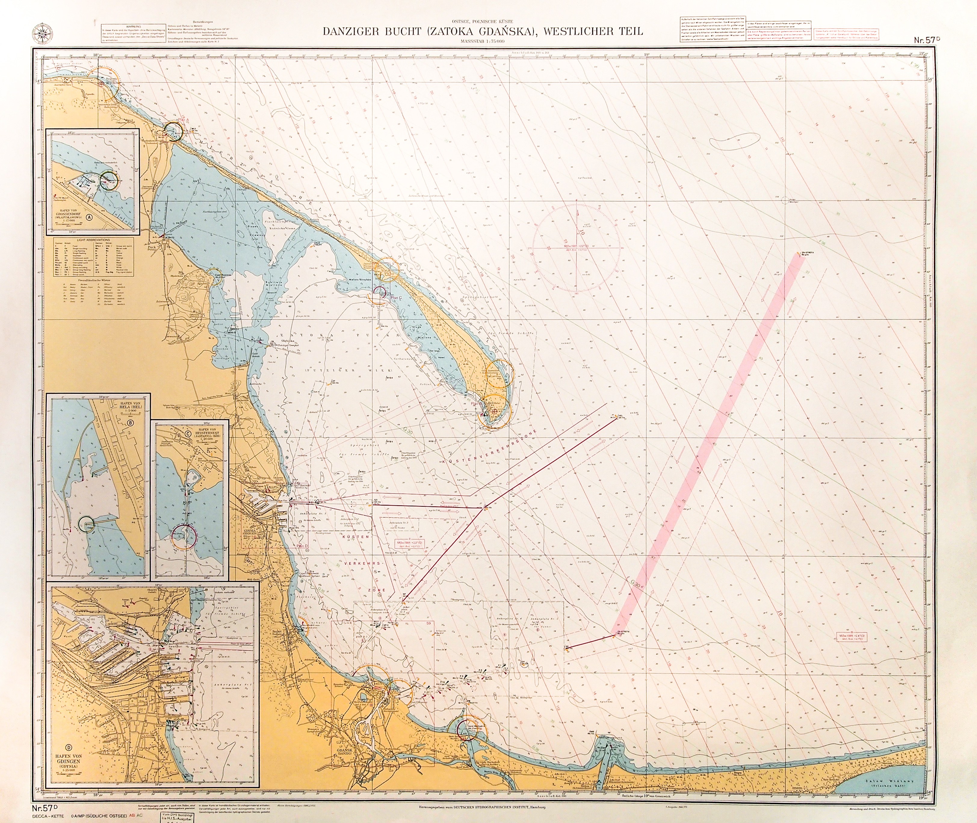
GDANSK BAY. Navigational map of the Gulf of Danzig with Danzig, New Port, and Hel Spit; Hamburg 1985; left p. 4 frames with more detailed maps of the ports of Wladyslawowo, Hel, Jastarnia, and Gdynia; on verso undated ownership stamp; color print, st. bdb., fold mark; map dimensions: 945x792 mm; Ostsee, Polnische Küste, Danziger Bucht (Gulf of Gdansk), Westlicher Teil.


![[MAP]. MAP OF POLAND 1 : 500 000. OLSZTYN. [Sheet ] 3. w-wa 1947....](https://img1.one.bid/img/6363/1859794_1x.webp?1713045600)


Recently viewed
Please log in to see lots list
Favourites
Please log in to see lots list