


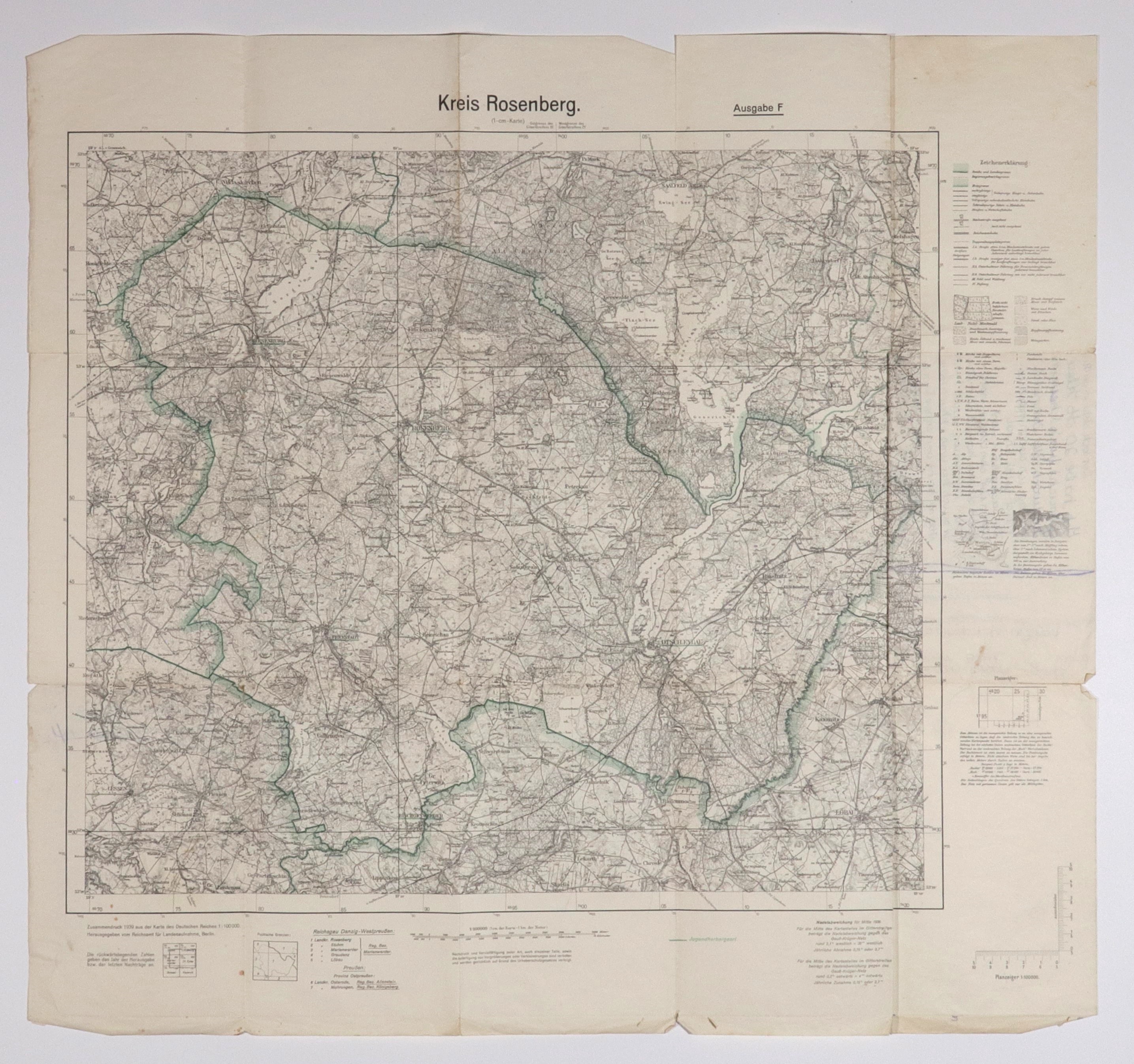
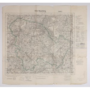
DRY. Topographical map District of Rosenberg, on the map, among others:Susz, to the north Mikolajki Pomorskie, to the south Biskupiec, scale 1 : 100,000, reprinted from Karte des..., published by Reichsamt..., Berlin 1939; legend, ff. , z line color, st db., folded, minor tears in folding areas, on verso handwritten annotations in German; dimensions ca. 640x605 mm; Kreis Rosenberg.


![[MAP]. MAP OF POLAND 1 : 500 000. OLSZTYN. [Sheet ] 3. w-wa 1947....](https://img1.one.bid/img/6363/1859794_1x.webp?1713045600)
![Poland car map. Cracow [1945].](https://img1.one.bid/img/6508/1873705_1x.webp?1713823200)
![Poland car map. Cracow [1945].](https://img1.one.bid/img/6508/1873705_2x.webp?1713823200)


![Dalhberg Erik Jonsson [Puffendorf] - Map of the Kingdom of Denmark and Pomerania (Szczecin)](https://img1.one.bid/img/5856/1829209_1x.webp?1712008800)


Recently viewed
Please log in to see lots list
Favourites
Please log in to see lots list