


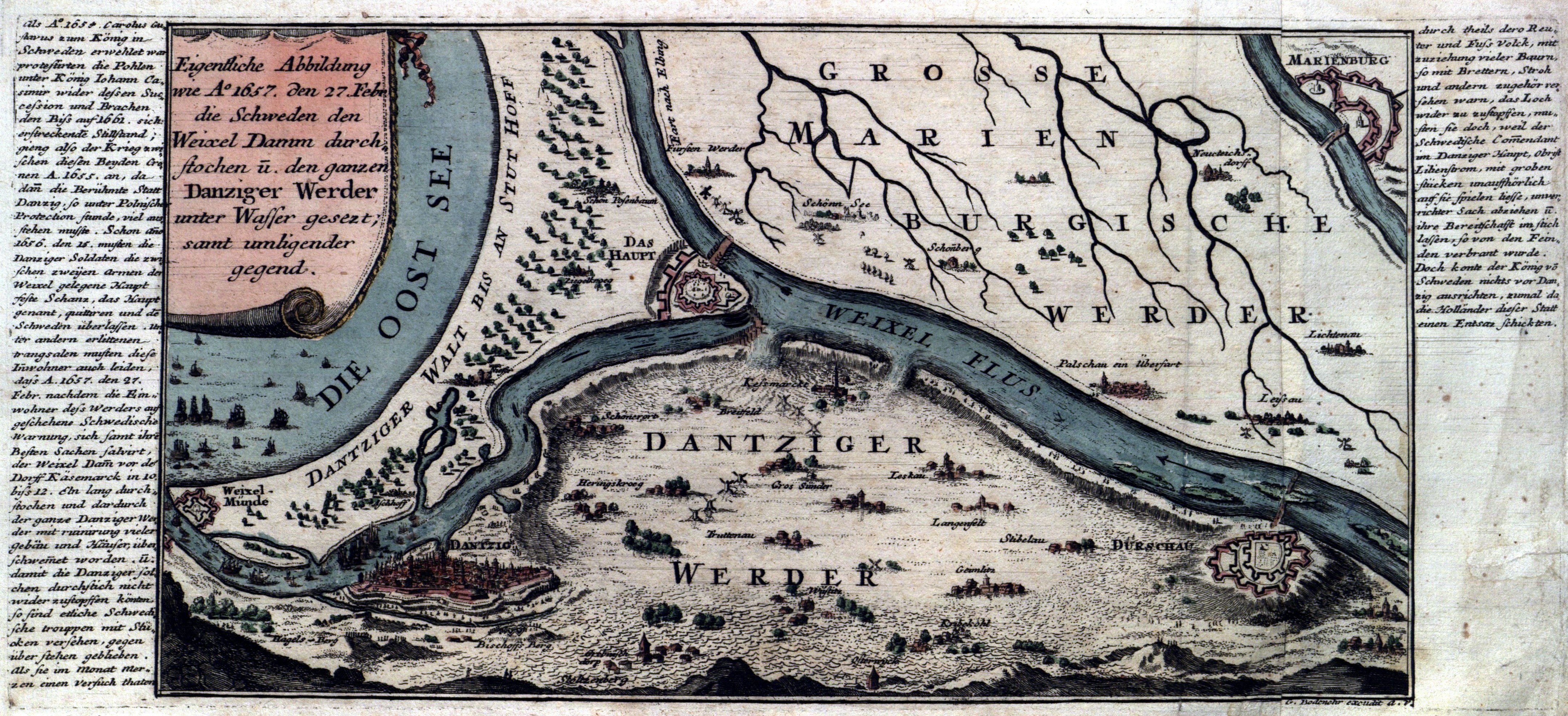
GDAŃSK. map of Żuławy from 1657, with a plan of fortifications of Wisłoujście Fortress, Gdańsk Head, Tczew and Malbork; published by G. Bodenehr, taken from: Force d'Europe..., Augsburg 1720-1740; copper. color, printed on 2 sheets; f.d., minor soiling; sheet dimensions: ca. 390x185 mm; Eigentliche Abbildung wie Ao 1657. den 27. Febr. die Schweden den Weixel...; [Von Danzig ...81] .


![[MAP]. MAP OF POLAND 1 : 500 000. OLSZTYN. [Sheet ] 3. w-wa 1947....](https://img1.one.bid/img/6363/1859794_1x.webp?1713045600)


Recently viewed
Please log in to see lots list
Favourites
Please log in to see lots list