


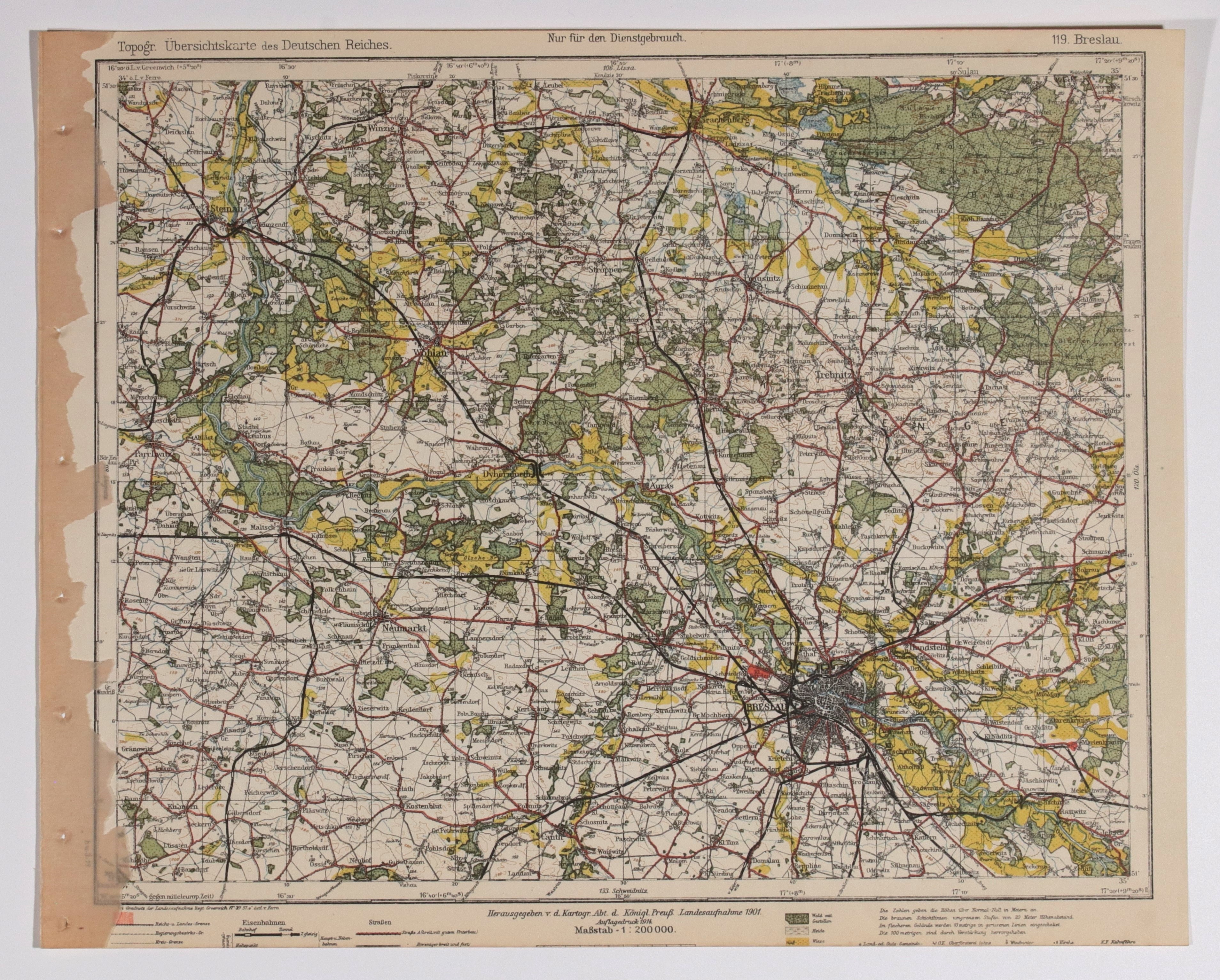
WROCŁAW. Topographical map of the Wroclaw area, the map also includes: Środa Śląska, Wołów, Trzebnica; derived from Topogr. Übersichtskarte..., scale 1 : 200 000, compiled. 1901, published by Reichsamt..., 1914; color; st. db., bottom portion trimmed; dimensions approx. 398x318 mm; 119. Breslau.


![[MAP]. MAP OF POLAND 1 : 500 000. OLSZTYN. [Sheet ] 3. w-wa 1947....](https://img1.one.bid/img/6363/1859794_1x.webp?1713045600)
![Poland car map. Cracow [1945].](https://img1.one.bid/img/6508/1873705_1x.webp?1713823200)
![Poland car map. Cracow [1945].](https://img1.one.bid/img/6508/1873705_2x.webp?1713823200)


![Dalhberg Erik Jonsson [Puffendorf] - Map of the Kingdom of Denmark and Pomerania (Szczecin)](https://img1.one.bid/img/5856/1829209_1x.webp?1712008800)


Recently viewed
Please log in to see lots list
Favourites
Please log in to see lots list