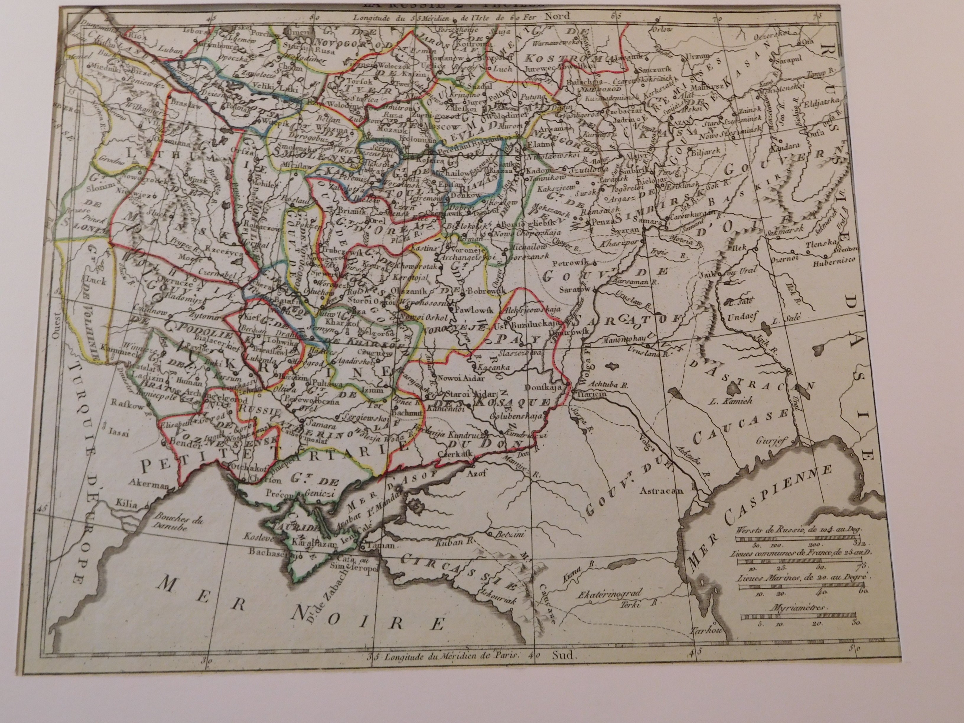
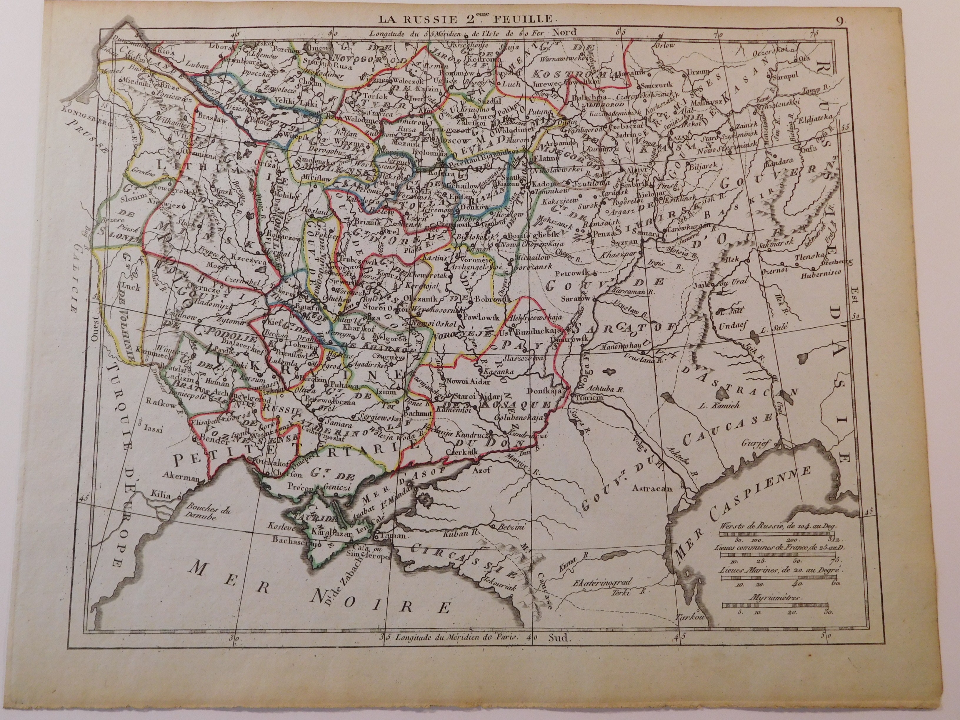
44. HERISSON EUSTACHE, RUSSIE 2EME FEUILLE.
Paris 1806, Jacques Desray, drawing and engraving. Eustache Hérisson (?), 22 x 18 cm; (card: 25.5 x 20.5 cm), passe-partout 50 x 32.5 cm.
Age-colored copperplate map of part of southern European Russia from the atlas of the famous geographer Eustache Hérisson (1759-1818), "Atlas Portatif" consisting of 45 cards. In the upper right corner the number "9", referring to the number of the map in the atlas. The map depicts a large part of the former Republic of Poland (Volhynia, Podolia, Grodno) and today's Ukraine (Kherson, Dnieper, Kyiv, Chernihiv). An interesting feature of the map is that the geographical name "Ukraine" is used for the area from Podolia to Kharkov. The map is framed in white passe-partout.
Piece bdb preserved, clear imprint of copperplate, clear colors, generally flawless.