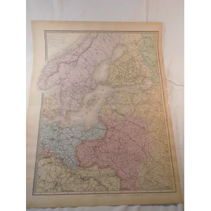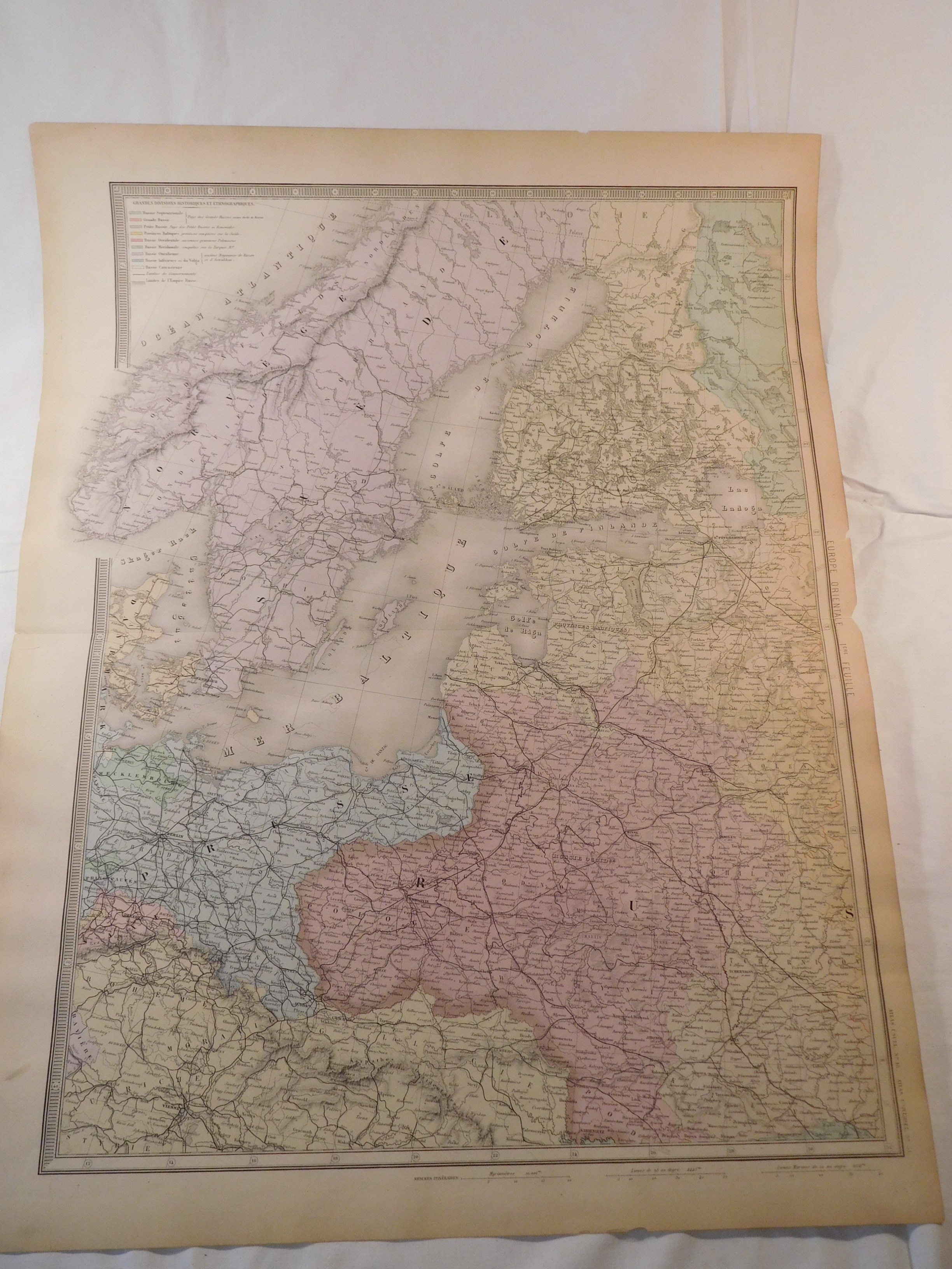

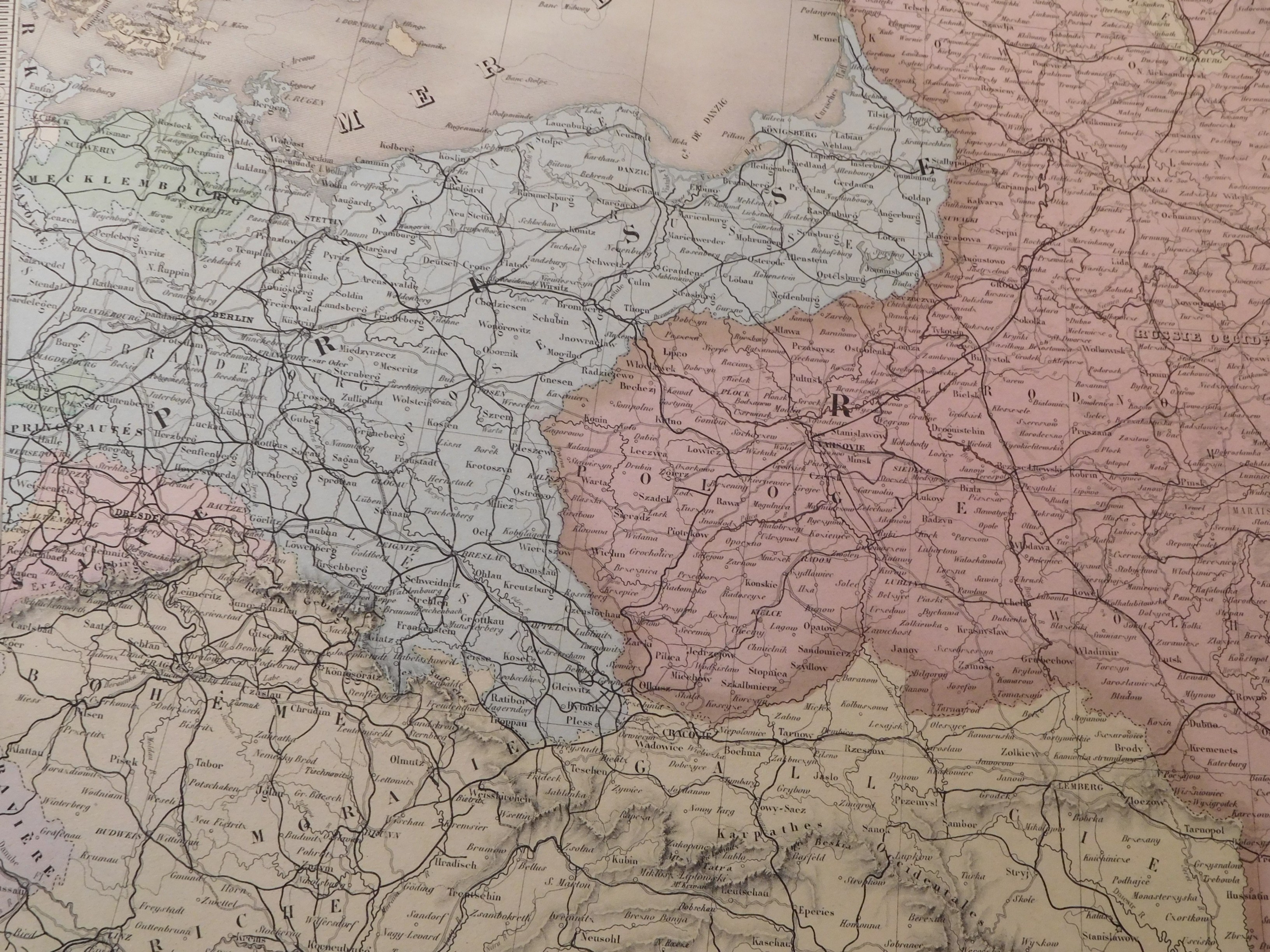
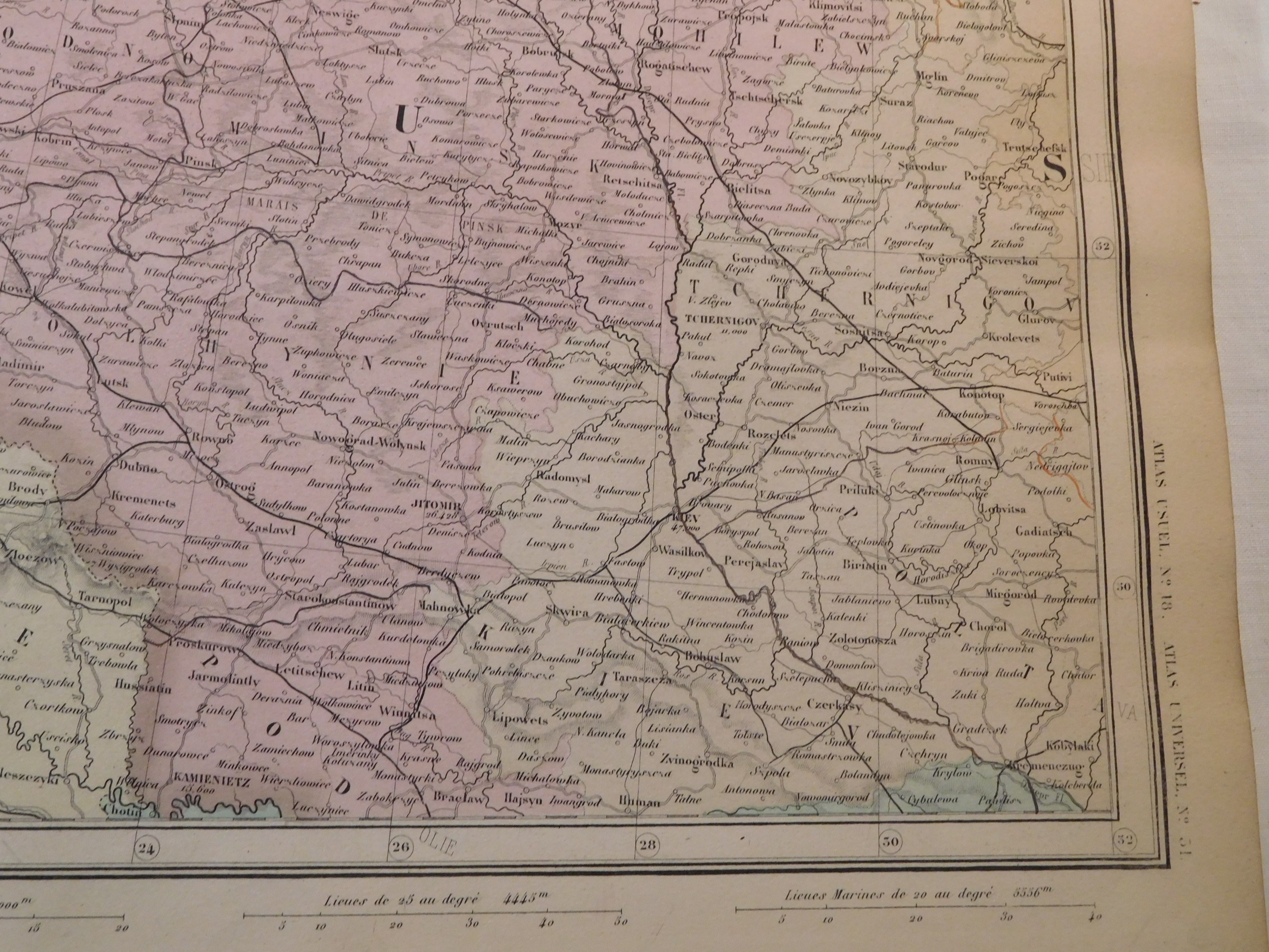
38. ANDRIVEAU-GOUJON EUGENE, CARTE DE L'EUROPE ORIENTALE(...) RUSSIE D'EUROPE, L'EMPIRE OTTOMAN ET LA GRECE.
Paris 1886, Eugène Andriveau-Goujon, eng. Eugène Andriveau-Goujon (?), 46.5 x 62 cm; (card: 52.5 x 69.5 cm).
Period colored map of European Russia card 1. It covers the area of European Russia and Poland, Sweden, Norway, Denmark, Prussia and the northern part of C.K. Austria . In the case of Poland, it refers to the area of the Kingdom of Poland created by the Congress of Vienna. In the legend, "Western Russia or the former provinces of Poland" is marked in salmon color. The map does not name Ukraine.
Piece moderately well preserved, clear colors, stains in margins and folds in margins; also a few tear marks, the largest in the left margin about 3 cm; map folded in half; otherwise flawless.


![[Térkép.] Magyarország gyógyhelyei és ásványvizeinek térképe. Tervezte Chyzer Kornél. Rajzolta Homolka József. 1886. ...](https://img1.one.bid/img/6570/1844247_1x.webp?1712700000)
![[Térkép.] Magyarország gyógyhelyei és ásványvizeinek térképe. Tervezte Chyzer Kornél. Rajzolta Homolka József. 1886. ...](https://img1.one.bid/img/6570/1844247_2x.webp?1712700000)