


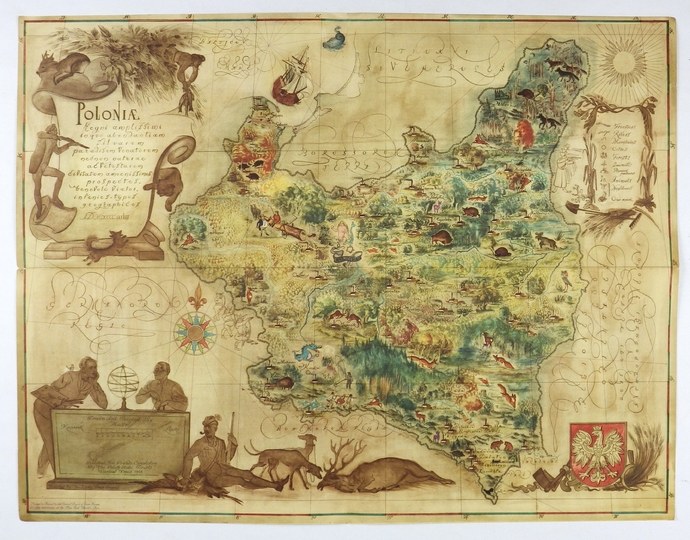
[POLAND]. Poloniae Regni amplissimi in quo abondantiam Silvarum, paradisum Venatorum nec non naturae ac Vetustarum civitatum amoenissimos prospectus [...]. Color map form. 34.8x45.2 cm.
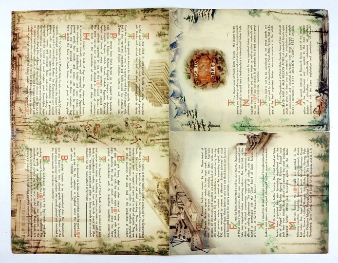
Imago Pol. H68/3. Map of Poland prepared by Eligiusz Kanarek (painter) and Tadeusz Lipski (cartographer), showing forests and hunting grounds of Poland. Map published in Warsaw by the Polish State Forests in 1938 for the World Exhibition in New York. Printed at Druk. "Sztuka" in Cracow. Title in cartouche in upper left corner, in lower left corner - stone plaque with names of authors and name of publisher and linear scale. On the right side, explanation of symbols and the coat of arms of the Republic. The staffage is stylized on the cartographic ornamentation of the 17th century. On the reverse side - an English text on forest resources and the development of industries related to them. The publication of the map caused protests from the German and Soviet embassies. The reasons were the silhouettes of armed warriors entering Poland from the west with their arms raised in a fascist salute (objection of the Third Reich) and, across the eastern border, an NKVD execution squad (outrage of the USSR). "A print run of the map was quickly withdrawn and destroyed as a result of protests by embassy representatives [...] The few surviving prints of the maps can be found, among others. in the Library of the Forestry Research Institute in Sękocin near Warsaw, the Polish Army Museum in Warsaw, the City Museum in Zabrze, as well as in the private collection of Tomasz Niewodniczanski in Bitburg, Germany" (J. Wiśniewska, B. Roźmiarek "The original map of [...] Kanarek and Lipski in the collection of the Mus. Forestry in Gołuchów). traces of folding and small tears on folds, good condition.


Recently viewed
Please log in to see lots list
Favourites
Please log in to see lots list