


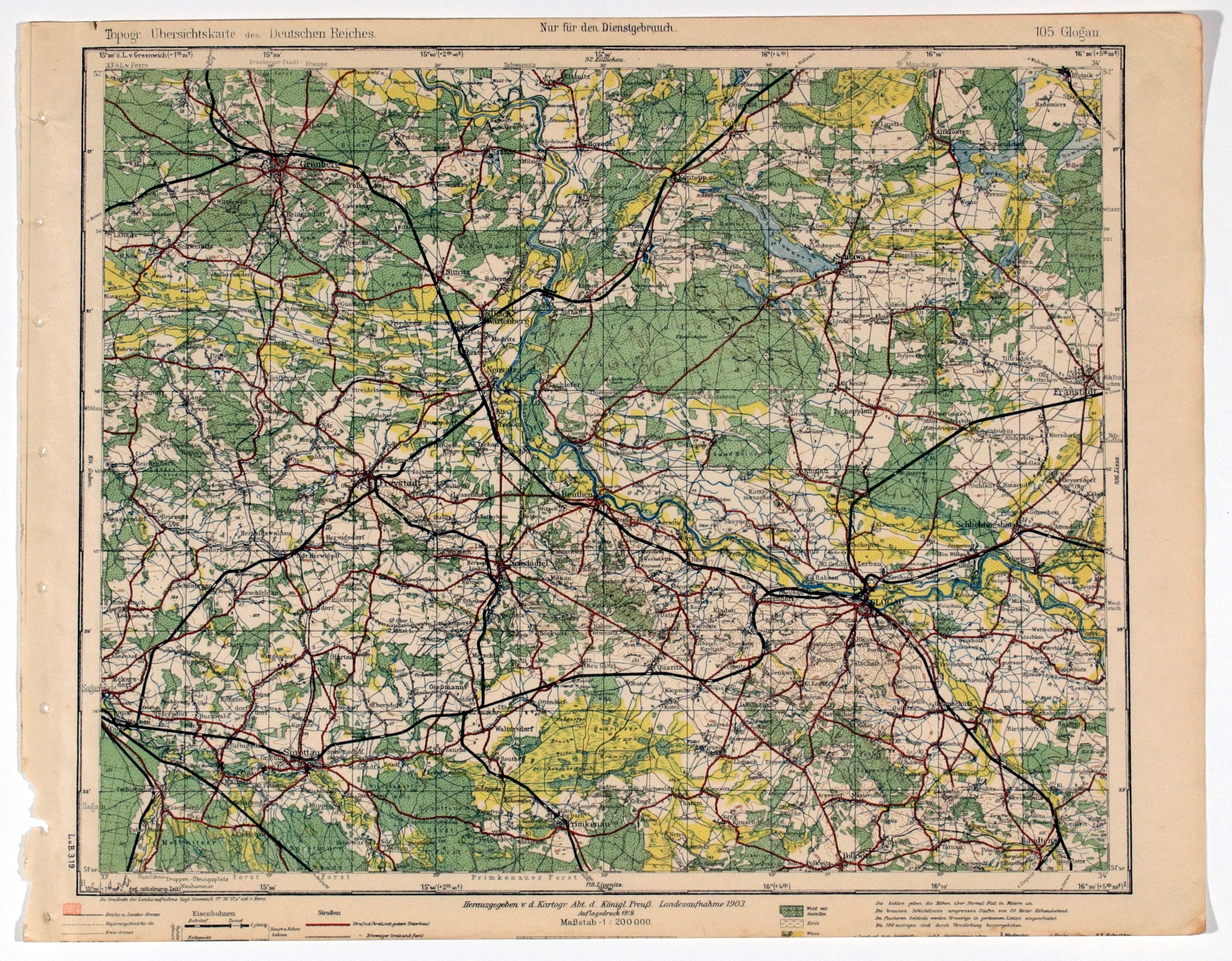
GŁOGÓW. topographic map of the Glogow area; map also includes: Wschowa, Kożuchów, Nowa Sól; taken from Topogr. Übersichtskarte..., scale 1 : 200 000, compiled. 1903, published by Reichsamt..., 1919, color; st. db., trimmed lower part; dimensions ca. 408x318 mm; 105. Glogau.


![Dahlberg Erik Jonsson [Puffendorf] - New fortifications of the city of Regiomontis](https://img1.one.bid/img/5856/1830502_1x.webp?1712095200)
![[MAP]. MAP OF POLAND 1 : 500 000. OLSZTYN. [Sheet ] 3. w-wa 1947....](https://img1.one.bid/img/6363/1859794_1x.webp?1713045600)
![Poland car map. Cracow [1945].](https://img1.one.bid/img/6508/1873705_1x.webp?1713823200)
![Poland car map. Cracow [1945].](https://img1.one.bid/img/6508/1873705_2x.webp?1713823200)
![Map of Bydgoszcz area [ca] 61x45, [post 1922].](https://img1.one.bid/img/6474/1885259_1x.webp?1714687200)
![Map of Bydgoszcz area [ca] 61x45, [post 1922].](https://img1.one.bid/img/6474/1885259_2x.webp?1714687200)
![Dalhberg Erik Jonsson [Puffendorf] - Map of the Kingdom of Denmark and Pomerania (Szczecin)](https://img1.one.bid/img/5856/1829209_1x.webp?1712008800)
![Dahlberg Erik Jonsson [Puffendorf] - Nowy Dwór nad Wisłą at the mouth of the Bugonarvi River](https://img1.one.bid/img/5856/1829207_1x.webp?1712008800)


Recently viewed
Please log in to see lots list
Favourites
Please log in to see lots list