


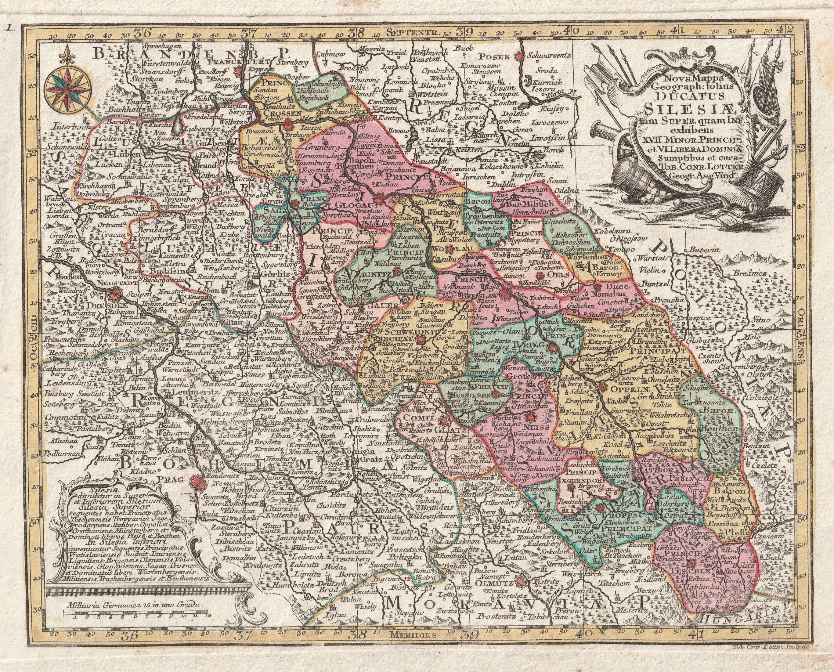
SLĄSK. Map of Lower and Upper Silesia, 1774; the part of Greater Poland bordering Silesia with Poznan is shown; ryt. T.C. Lotter, taken from Atlas Minor praecipua orbis terrarum imperia [...], T.C. Lotter; copper. colored, st. bdb., minor soiling and rust spots; plate dimensions 263x180 mm; Nova Mappa Geograph: totius DUCATUS SILESIAE tam SUPER [...].


![[MAP]. MAP OF POLAND 1 : 500 000. OLSZTYN. [Sheet ] 3. w-wa 1947....](https://img1.one.bid/img/6363/1859794_1x.webp?1713045600)


Recently viewed
Please log in to see lots list
Favourites
Please log in to see lots list